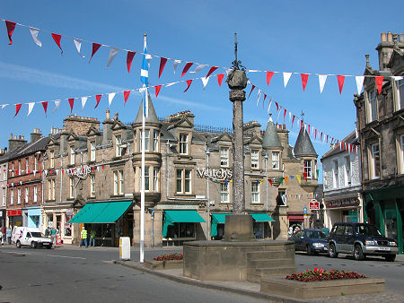
 Market Place and Mercat Cross |
Peebles lies at the confluence of the River Tweed, flowing east towards Berwick-upon-Tweed and the sea, and the Eddleston Water flowing from the north, whose valley has long been an important communications route between Edinburgh and the Scottish Borders.
Settlement in the area dates back thousands of years, as shown by the hill forts in the area and by the remains of a nearby Roman road and a Roman fort at Lyne. Some time after the Romans' brief stay this section of the Tweed Valley was part of the Kingdom of Strathclyde, only finally becoming part of Scotland under Malcolm II in 1016.
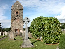
A church had been established on the west side of today's Peebles in the 600s. Its probably site was later used for a parish church consecrated in 1195, whose partial remains still stand as St Andrew's Tower. This church was destroyed by the English in 1548. After the Reformation of 1560, Cross Kirk, previously an abbey church just half a mile to the east of St Andrew's, became Peebles' new parish church. This was made redundant in 1784 by a new church built closer to the centre of Peebles, and in 1887 this in turn was replaced on the same site by the Old Parish Church which today dominates the High Street and the Tweed Bridge.
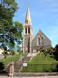
Other churches in the town form a cluster overlooking the river towards the east end of the town. Most striking is the Leckie Memorial Church with its 146ft spire, built in 1876. Next to it is the less assuming St Peter's Episcopal Church from 1830 and also nearby is what used to be the Free Church, built in 1872.
Peebles' strategic position was reflected by the building of a castle here in the 1100s, certainly before David I made Peebles a Royal Burgh in 1152. This was located on Castle Hill, a site at the west end of the High Street today occupied by the Old Parish Church. It guarded the wooden bridge across the River Tweed and was occupied by the English in the wars of the early 1300s (see our Historical Timeline).
Accounts differ about the eventual fate of Peebles Castle. It may have been destroyed when the English burned the town in 1403, or when they did so for a second time in 1548. Or part of the castle may still have been standing and reused for its stone when the predecessor of today's Parish Church was built on the site in 1784.
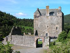
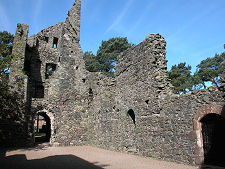
More enduring was Neidpath Castle, overlooking the Tweed a mile to the west of Peebles. With origins in 1370, much of today's structure dates back to the 1500s and 1600s. In 1810 the castle was brought by the Earl of Wemyss, whose family still occupy it.
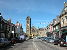
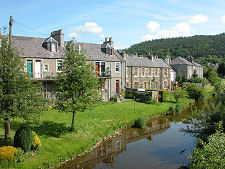
Today's Peebles is an attractive and bustling town whose heart lies in its main shopping street, formed by High Street and Eastgate. This area was largely built in the second half of the 1500s, on a spur of land between the River Tweed and the Eddleston Water.
Perhaps this was thought to be a more defensible site than the "Old Town" on the west side of the Eddleston Water which had been largely destroyed by the English in 1548. Where High Street and Eastgate meet is the Mercat Cross. This has occupied its current traffic island site only since 1965, but in part it dates back to the 1660s. Set back on the south side of High Street behind its cobbled courtyard is the excellent Tontine Hotel, whose name reflects the original method by which it was funded.
Close by on the south side of High Street is the lovely courtyard setting of the Tweeddale Museum and Gallery, part of the Chambers Institution. Within the archway leading to the courtyard is the entrance to the John Buchan Story, with exhibits about the life of the novelist and diplomat. Set behind the High Street are the broad grassy and tree-line banks of the River Tweed.
This is crossed by Tweed Bridge close to the Old Parish Church, the first stone bridge across the Tweed and originally built in 1426. It was altered in 1799 and widened from 8ft to 21ft in 1834 and then to 40ft in 1900. There is a large stone inscription on the parapet commemorating the 1834 widening "by subscription". Below Eastgate the River Tweed is crossed by the Priorsford Bridge, an iron suspension pedestrian bridge built in 1905 to replace an earlier one from 1817.
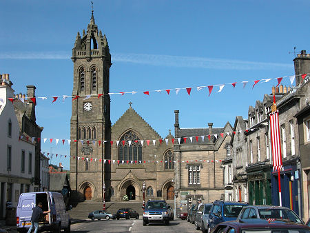 West End of High Street and the Old Parish Church |

|
|
|
Visitor InformationView Location on MapWhat3Words Location: ///blotches.scout.skill |
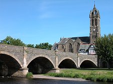 Tweed Bridge and Old Parish Church |
 The Bridge Inn |
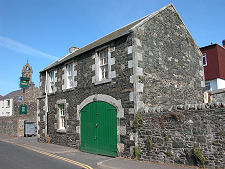
 School Brae |
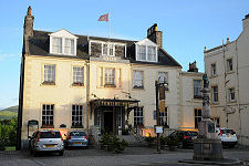 The Tontine Hotel from High Street |
 Rear of the Tontine Hotel |
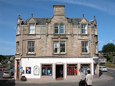 Old Town Shops |