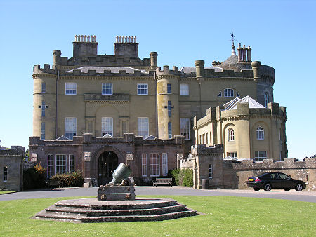
 Culzean Castle, South Ayrshire |
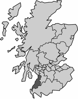
South Ayrshire is one of the 32 unitary council areas into which Scotland has been divided since 1996. It extends from Troon, Prestwick and Ayr in the north along the Firth of Clyde to Girvan and Ballantrae in the south. Inland settlements include Barrhill and Maybole. For accommodation in South Ayrshire and a full list of features, see our Ayrshire area pages.
 South Ayrshire Since 1996 Note About Image Copyright |
South Ayrshire is the 15th largest Scottish council area in terms of physical size and the 17th largest in terms of population. It is an area of considerable contrasts. In the north it is quite built up in character, with a series of towns along the coast plus Prestwick Airport. As you head south it becomes increasingly rural, especially if you head inland into what becomes the fringes of the Galloway Forest Park. South Ayrshire is crossed from north to south by the A77 trunk road, the main road from Glasgow to the ferry terminals at Cairnryan and Stranraer.
South Ayrshire is bordered on its north by North Ayrshire; on its east by East Ayrshire; and on its south by Dumfries and Galloway.
From the point of view of local authority coverage, the 1996 reorganisation that discarded Scotland's 12 regions in favour of 32 unitary council areas saw South Ayrshire formed from the Kyle & Carrick district of Strathclyde Region. If you take a longer view and compare South Ayrshire to the traditional counties of Scotland before they were replaced by regions in 1975, it occupies the south-western part of the traditional county of Ayrshire.

