 View Over Stranraer from the Castle of St John |
Stranraer is the largest settlement in south-west Scotland. It lies at the head of Loch Ryan, on the north side of the neck of land that prevents the Rhins of Galloway becoming an island.
The town's origins date back nearly 500 years to the building in about 1510 of Stranraer Castle, also known as the Castle of St John. This now stands in the centre of the town, but it was originally built behind the broad beach at the head of Loch Ryan. Only later did a settlement begin to grow around it. The Castle of St John now houses a museum and offers great views over the town, while the excellent Stranraer Museum can be found in the old town hall.
By 1600 Stranraer had become the market town for the Rhins of Galloway to the west and the rural areas to the east. In the 1760s it was reached by a military road built from Bridge of Sark on the English border via Dumfries to Portpatrick. This in turn led to Stranraer featuring on the drove route used by Irish cattle being moved to market in Dumfries. (Continues below images...)
 Loch Ryan Glimpsed Down Street |
 West Pier |
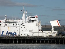
It was only in the mid 1700s that a harbour was first built in Stranraer itself, and further port development took place in the 1820s. But it was the coming of the railway from Dumfries in 1861 that finally established Stranraer as the area's main port.
In 1862 the line was extended to serve the harbour directly, and in the same year a link to Portpatrick was also opened. Some time later a rail connection north to Girvan was established.
For much of the following 150 years Stranraer was unchallenged as the natural location for the main Scottish port for the Irish ferries. Roll-on roll-off ferries appeared on the Irish routes well ahead of elsewhere in the UK. This played a part in the loss of 133 lives on 31 January 1953 when the MV Princess Victoria's car deck was swamped by heavy seas en route from Stranraer, and the ship sank off Northern Ireland.
In the 1970s P&O moved their services from Stranraer to a new terminal built nearer the mouth of Loch Ryan south of Cairnryan and in 2000 the SeaCat fast catamaran service from Belfast was switched from Stranraer to Troon. In late 2011 Stena also moved their Stranraer operations to a purpose-built terminal just north of Cairnryan.
But despite these setbacks, Stranraer has rather more going for it than usually gets mentioned in the guide books. The town centre is surprisingly attractive and bustling, and while it helps to see it on a sunny day, the whites and bright colours of many of the buildings make it brighter in any light. The railway station was built to serve the ferry terminal and is now oddly separated from the town itself: but as we were told when we last visited, the trains weren't timed to meet the ferries even when there were ferries.
Stranraer also serves as the gateway to the Rhins of Galloway. Roads from here head north to Leswalt and south past Drummore to the Mull of Galloway, Scotland's most southerly point. And west lies Portpatrick, now a beautiful resort complete with harbour. Another link with Portpatrick is provided by the Southern Upland Way long distant footpath, which begins there and passes just to the south of Stranraer itself en route to the North Sea. The Kirkpatrick C2C, a 250 mile cycle route to Eyemouth, starts on Stranraer's West Pier.
 The Castle of St John |

|
|
|
Visitor InformationView Location on MapWhat3Words Location: ///dearest.titles.baked |
Stranraer In Fiction
|
 Friend or Foe? by Ken Lussey (14 July 2025).
 Shopping Street |
 Doorway |
 Harbourmaster's Office |
 Start of Cycle Way to Eyemouth |
 Railway Station |
 Railway Station |
 The Long-Closed Ferry Terminal |
 Stranraer Community Church |


