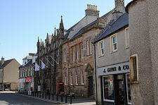
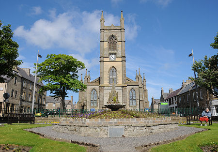
 St Peter's & St Andrew's Church seen from Sir John's Square |
Thurso is mainland Scotland's most northerly town, and home to the country's most northerly railway station. Located on the north coast of Caithness, its seaward views are dominated by the distant cliffs of Dunnet Head to the north-east, and those of the island of Hoy, one of the Orkney Islands, to the north.
Modern Thurso tends to be seen as a stepping stone en route to somewhere else rather than as a destination in its own right, although in recent years the sometimes turbulent seas of the Pentland Firth have led to the town becoming an unlikely focus for fans of surfing from all over the world.
Thurso has long been a gateway to Orkney, with the best established of the ferry routes to Orkney, the car ferry to Stromness, leaving from the harbour at Scrabster, a mile and a half to the north-west. (Continues below image...)
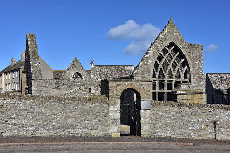 Old St Peter's Kirk |
Thurso's origins are revealed in its name, which comes from the Old Norse for Bull's River. The Vikings were well established here from as early as the 900s, using the river mouth as a port and a fishing base. After Caithness became more securely part of Scotland in medieval times, Thurso continued to grow around its fishing and trade, in a triangular area formed by the River Thurso to the south-east and the shore of Thurso Bay to the north. This area is still known as Old Thurso or the old town.
Not a great deal remains of medieval Old Thurso except for the roofless Old St Peter's Kirk. Parts of this date back to the early 1100s and it seems to have been expanded and altered at various points over the next seven centuries before being abandoned in 1832.
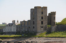
Nearby Shore Street is very picturesque, and Thurso's seafront is well worth exploring. From here you can see the rather sad remains of Thurso Castle on the eastern side of the river mouth. On the site of earlier castles dating back to the 1100s, this was largely replaced by a grand Scots Baronial mansion in the 1870s. It caught fire and was subsequently partly demolished in 1952.
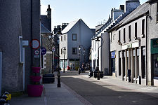
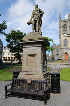
If you follow the pedestrianised High Street and Rotterdam Street. This was created in the years from 1798 by Sir John Sinclair of Ulbster, using wide streets laid out on a regular grid. This grid remains in place today. At its heart is what is now known as Sir John's Square, in which you find a statue of Sir John Sinclair. This is slightly eclipsed by the impressive war memorial at the south-east or lower end of the square. The upper end of the square is filled by the Gothic splendour of St Peter's and St Andrew's Church. This was completed in 1832 by the architect William Burn, at which point Old St Peter's Kirk became redundant.
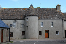
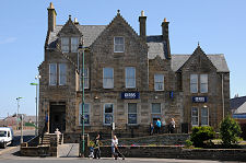
Other things to look out for in the new town include Meadow Well, a circular wellhouse completed in 1823, and the fine public library, originally the Miller Institution, which since it was completed in 1862 has terminated the view down the length of Traill Street, one of Thurso's main through streets. Less obvious is the impressive Janet Street overlooking the River Thurso close to Thurso Bridge.
Thurso's most recent bout of growth followed the establishment from 1954 of the Dounreay Nuclear Power Development Establishment at a disused wartime airfield eight miles to the west of the town. At its peak in the 1970s Dounreay employed 3,500 people, many of whom lived in Thurso. Employment levels have declined since then, but the task of decommissioning the establishment will ensure a significant contribution to the economy of the area for decades to come.
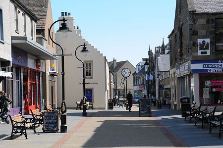 Rotterdam Street and High Street |

|
|
|
Visitor InformationView Location on MapWhat3Words Location: ///wiped.lawyer.cement |
 Public Library |
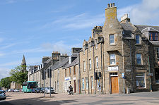 Traill Street |
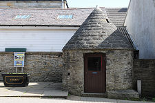 Meadow Well |
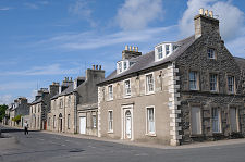 Janet Street |
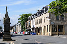 Princes Street |
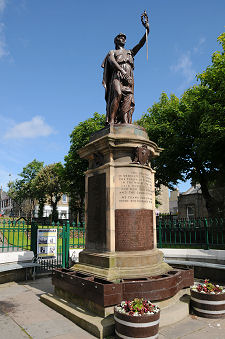 War Memorial |
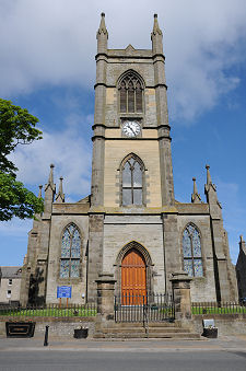 St Peter's & St Andrew's Church |
