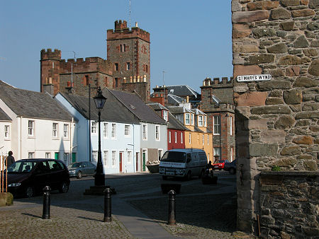
 Kirkcudbright, in Kirkcudbrightshire until 1975 |
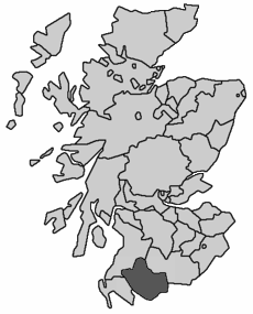
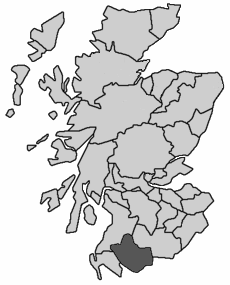
Kirkcudbrightshire, also known as The Stewartry of Kirkcudbright or East Galloway, was one of the 34 traditional counties into which Scotland was divided for administrative purposes. It occupied the eastern half of the ancient Kingdom of Galloway.
 Kirkcudbrightshire, 1890 to 1975 Note About Image Copyright |
Kirkcudbrightshire was bordered to the west by Wigtownshire; to the north by Ayrshire; and to the east by Dumfriesshire. The main settlements were Dalbeattie, Castle Douglas, Kirkcudbright, Gatehouse of Fleet, St John's Town of Dalry, New Galloway and New Abbey. The county town was Kirkcudbright. A tidying up of the map of counties which reduced their number to 33 in 1890 had no effect on Kirkcudbrightshire, which as a result remained a county in its own right until reorganisation in 1975 swept all the counties away in favour of 12 regions.
The regions formed in 1975 were the upper tier of a two tier local authority system, and the area which had formed Kirkcudbrightshire became part of the region of Dumfries & Galloway. Most regions were divided into a number of district council areas, and Dumfries & Galloway had four of them.
The core of the area that had formed Kirkcudbrightshire became the Stewartry District of Dumfries & Galloway region, though parts of Kirkcudbrightshire found their way into Wigtown District, to the west, and Nithsdale District to the east, with the result that Stewartry District was rather smaller than Kirkcudbrightshire had been.
Regions and districts disappeared from the scene in a major reorganisation in 1996, being replaced by 32 unitary council areas. What had started out as the traditional county of Kirkcudbrightshire is today part of the unitary council area of Dumfries & Galloway. For administrative purposes, Dumfries & Galloway continues to be divided into four management areas based on the former districts. As a result, the core of what was Kirkcudbrightshire now forms the Stewartry management area.