Ard Neackie & Loch Eriboll |
As it heads east from Cape Wrath, the north coast of Scotland is deeply indented by a series of sea lochs and river estuaries. The Kyle of Durness and the Kyle of Tongue are two, but the widest and longest is Loch Eriboll. The name comes from the Norse "Eyrr-bol", or "Farm on a beach".
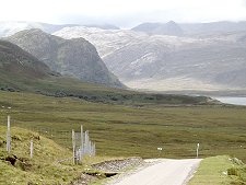
A few miles east of Durness the main road turns to begin its ten mile detour south-west to where Loch Eriboll ends, amid the mountainous heart of north-west Sutherland. Having rounded the end of the loch, the road then makes its way north-east to the point at which it climbs above the wonderful near-island of Ard Neakie and heads east towards Tongue. The loch is around a mile wide for much of its length, widening considerably as it reaches the sea.
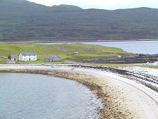
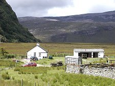
As the road progresses down the west side of Loch Eriboll it passes through the strung out crofting township of Laid. This was created in 1832 to house people cleared from Eriboll, on the far side of the loch, to make way for sheep. Today it is made up of 18 crofts, and after many decades of steady decline that included the closure of the school in 1955, it has seen a revival in recent years and is now home to seven families on a permanent basis.
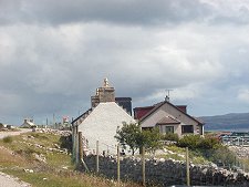
The loch's other settlement is the now tiny Eriboll, on the main road above the east side of the loch. From this side you have a much higher viewpoint and gain some wonderful views of the mountainous landscape. Cranstackie and Beinn Spionnaidh loom to the south-west of the loch, but the best views are beyond them to the exceptionally wild country in the direction of two of Scotland's most remote and challenging mountains, Foinaven and Arkle.
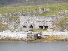
Loch Eriboll's most intriguing and attractive feature is Ard Neackie. This is a mound of land prevented from becoming an island by an umbilical cord of sand and shingle linking it to the east shore of the loch where the Tongue road descends from the moorland to the east.
Ard Neackie was used as the terminus of the Heilam Ferry, which crossed the loch to the - now gone - Heilam Inn on the west bank of the loch at Portnancon. The ferry ceased operation in the 1890s when the road around the loch was completed, but the ferry house built in 1831 still stands, though sadly increasingly derelict. Ard Neackie is also notable for the four large lime kilns built in 1870. The Reay estate produced large amounts of lime here and on the nearby island of Eilean Choraidh and loaded it into ships.
The roads around Loch Eriboll, and those leading to it, are single track. For more information about Scotland's single track roads and how to drive them, visit our feature page on driving single track roads.