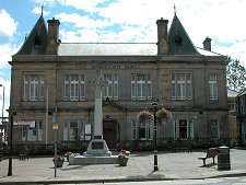
 Victoria Street and Town Hall |
Newton Stewart is an important market town. It serves as the centre for a large rural area that includes the vast and sparsely populated Galloway Forest Park to its north and the broad peninsula of The Machars to its south.
The town lies on the west bank of the River Cree at what for many centuries was the lowest point it could be crossed. On the opposite side of the river is the much smaller settlement of Minnigaff. Its name probably comes from the Gaelic Muillin an Ath or "Mill by the Ford" and it seems likely that it was already well established by the 1200s.
The area around the west end of the ford across the River Cree was probably settled throughout this period, but Newton Stewart only arrived on the scene in 1677. It was built as a planned town by the Stewart family of Castle Stewart, and by as early as 1685 it had already overtaken Minnigaff in size and importance.
The ford across the River Cree was made redundant by a bridge in 1745. This was washed away in floods in 1806, and in 1813 it was replaced by the Bridge of Cree that today still links Newton Stewart and Minnigaff.
From the 1760s the town benefitted from being on the route of the military road built from Bridge of Sark on the English border via Dumfries to Portpatrick. The crossing later became an important staging point on the drove road for Irish cattle en route to market in Dumfries.
In 1792 the Stewart family's estates in the area were brought by William Douglas. He introduced cotton mills to the town and changed its name to Newton Douglas. Neither the change of name nor the cotton mills outlived him by long.
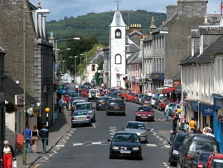
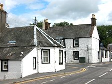
For a town whose main through route has historically run east to west, Newton Stewart is remarkably elongated from north to south, running for well over a mile along the west bank of the River Cree. Since the building of a bypass on the A75 to the south of the town in 1978 the main through route has been the A714. This is variously called Arthur Street north of the Bridge of Cree, Victoria Street through the main centre of the town, and then Albert Street before finally becoming Queen Street as it heads through the southern part of Newton Stewart.
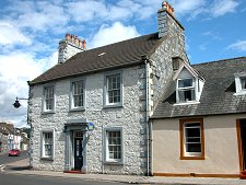
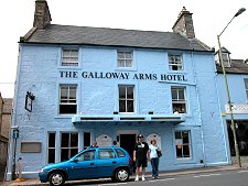
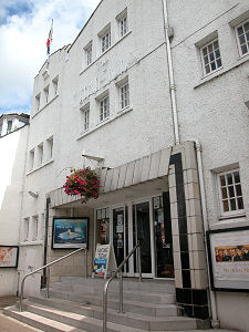
This main street is punctuated by a series of attractive buildings. Near the Bridge of Cree is the Town Hall, dating back to 1800. In need of a fresh coat of white paint when we visited, this remains nonetheless a distinctive landmark. Nearly opposite is the blue Galloway Arms Hotel, while further along Victoria Street is the Cinema, remarkable both in surviving at all and in looking much as it must have done when built in the 1920s.
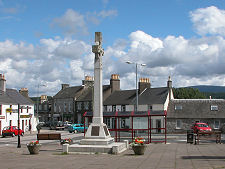
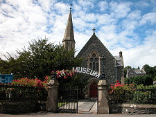
Albert Street becomes Queen Street at Dashwood Square, the open area in front of the McMillan Hall. This is also the terminus of Jubilee Road and Church Street, which run parallel to the main street but offer a dramatic contrast to its bustle. Here you find the Parish Church, Gothic in style and dating back to 1840. Nearby is the town's Museum, housed in the former Newton Stewart Presbyterian Church. Also close by Dashwood Square is the Tourist Information Centre.
 Wider View of Victoria Street |

|
|
|
Visitor InformationView Location on MapWhat3Words Location: ///bride.pegs.warned |
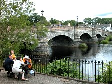 Bridge of Cree |
 Minnigaff |
 The Cinema |