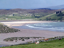
 A View Over Bettyhill |
Bettyhill is a fairly recent creation. The original village in the area was Farr, now a crofting settlement lying a mile north-east of Bettyhill beyond the sands of Farr Bay. What changed things was the coming of the Highland Clearances.
The long valley of Strathnaver runs for nearly 20 miles south from Bettyhill and is followed by the B871 as it makes its way towards Altnaharra.
It was once heavily populated. The strath formed part of the 1.5 million acre estates of the Countess of Sutherland and her husband, the Marquess of Stafford (later to become the Duke and Duchess of Sutherland), from which 15,000 people were cleared between 1811 and 1821, mostly by the estate factor, Patrick Sellar. The Countess of Sutherland, in a move unusual for the time, had a resettlement village built near the coast on the east side of the mouth of the River Naver. This she named after herself as Bettyhill. (Continues below images...)
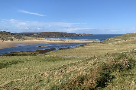
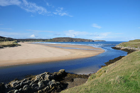 Torrisdale Bay |
 The River Naver |
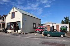
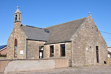
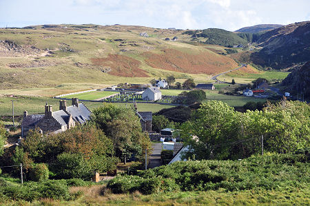
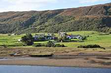
Bettyhill today has three distinctly different areas. The main centre is focused on the more modern housing and the Bettyhill Hotel, found on the main road as it climbs to the east above the River Naver. Spreading east from this in a sheltered bowl are the older areas of settlement, including the Parish Church of Farr, now the Strathnaver Museum. To the north is the rock framed sandy beach of Farr Bay and, to the west and beyond the River Naver, the still more stunning expanse of sand making up the north-facing Torrisdale Bay.
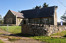
Farr Church was built in 1774 and, to give an indication of the population of the area at the time, could accommodate 750 people. By 1882, clearance, emigration and splits in the church meant that the upper galleries could be removed leaving a much smaller capacity building. It was converted into a museum in the 1970s. Nearby is the Tourist Information Centre.
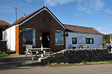
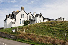
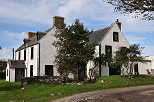
The Bettyhill Hotel started life in 1819, though it has grown steadily since. Its location is superb, giving magnificent views to the north-west over Torrisdale Bay. At other end of the village is the Farr Bay Inn, built as a manse in 1819.
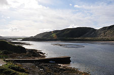
Making your way to the north then west from the main part of the village brings you to Bettyhill's now rather lonely pier, in the mouth of the River Naver and opposite a wide expanse of rock-backed dunes. In the early days of the village this formed an important fishing station. Today little but the pier itself remains, and even the name, Navermouth, no longer appears on Ordnance Survey maps.
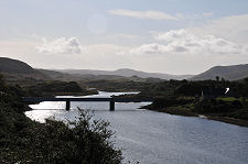
As you approach Bettyhill from the west you cross the River Naver via a striking metal and stone bridge built in 1977. At its eastern end a minor road heads south to the Ciolle an Borgie Cairns and the slight remains of the Achanlochy cleared township.
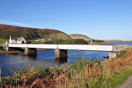 Bridge Over the River Naver |

|
|
|
Visitor InformationView Location on MapWhat3Words Location: ///placed.mouth.logbook |
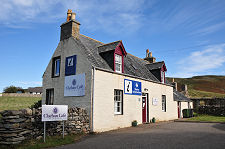 Cafe and Tourist Information |
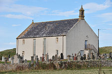 Strathnaver Museum |
 Farr Bay Inn |
 Bettyhill Pier |
 Invernaver |
 Coille na Borgie Cairns |
 Achanlochy Clearance Township |