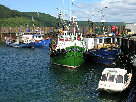
 Carradale Harbour |
Argyll & Bute is one of the 32 unitary council areas into which Scotland has been divided since 1996. It extends from Campbeltown and Kintyre in the south to Bridge of Orchy and the Isle of Mull in the north, and to Helensburgh and Loch Lomond in the east. For accommodation in Argyll & Bute and a full list of features, see our Oban & Lorn, Mid Argyll and Kintyre and Cowal, Bute & Eastern Argyll area pages.
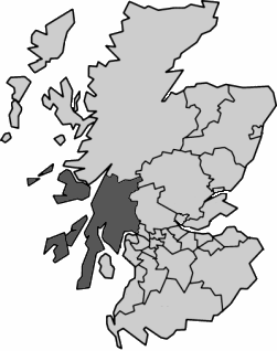 Argyll and Bute Since 1996 Note About Image Copyright |
Other important settlements in Argyll & Bute include Tarbert, Lochgilphead, Dunoon, Oban, Dalmally and Inveraray; it also includes Islay and Jura and the Isle of Bute. Argyll & Bute is the second largest council area in Scotland by size, but only the 22nd largest by population, reflecting a largely rural character. The coastline of Argyll & Bute is deeply indented in places and is said to be longer than the coastline of France.
Argyll & Bute is bordered to its north by Highland, and to its east by Perth & Kinross, Stirling and West Dunbartonshire. Parts of the eastern side of Argyll & Bute also fall within the area of the Loch Lomond & The Trossachs National Park.
From the point of view of local authority coverage, the 1996 reorganisation that discarded Scotland's 12 regions in favour of 32 unitary council areas saw Argyll & Bute formed by merging the area of Argyll District of Strathclyde Region and parts of the area of Dumbarton District around Helensburgh and to the west of Loch Lomond. If you take a longer view and compare Argyll & Bute to the traditional counties of Scotland before they were replaced by regions in 1975, you find it covers most of the traditional county of Argyll, though without the Ardnamurchan area or Ballachulish and Kinlochleven, which were lost to Highland in 1975. It also includes the Isle of Bute, which formed part of the traditional County of Bute; while Helensburgh and the area to the west of Loch Lomond, formed part of the traditional county of Dunbartonshire.

