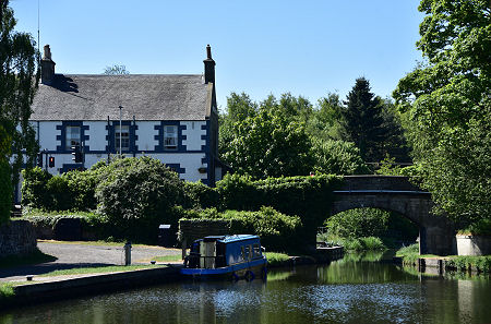
 The Bridge Inn and the Union Canal at Ratho |
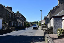
Ratho stands on the south-east side of the plain of the River Almond and feels oddly secluded despite being only eight miles in a straight line from the centre of Edinburgh and under two from Edinburgh Airport. The name is thought by some to come from the old Gaelic for fortress, and while no remains of an ancient fortress exist, it is clear that the village dates back at least a thousand years.
The best evidence for its age lies towards the northern edge of the village, where you find St Mary's, or Ratho Parish Church. Parts of St Mary's can be dated as far back as the 1100s, and it has been steadily added to and expanded since: to the point where the later extensions almost completely hide the original church. Not far from Ratho is a second St Mary's Church, an Episcopal church built in 1850 on the edge of the nearby Dalmahoy Estate.
With the exception of the Huly Hill Cairn, a mile and a half to the north, nothing else still standing in Ratho is as old as the early parts of the parish church, though by the 1400s Hatton Castle stood a mile or so to the south-west of today's village. This was developed into Hatton House in the 1660s, which burned down in 1952 and the ruins were later demolished. The most recent additions to the surrounding landscape are the spectacular Edinburgh International Climbing Arena and the equally amazing Lost Shore Surf Resort. (Continues below images...)
 Ratho Marina |
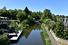
 A View of the Village from the Canal |
Ratho itself grew steadily until 1822. That was the year in which the Union Canal opened, linking Edinburgh to Falkirk and the Forth and Clyde Canal. The canal is 31½ miles long and follows the 240ft or 73.1m contour the whole way, thus avoiding the need for any locks throughout its length. It just so happens that the 240ft contour passes through Ratho between the main part of the village and St Mary's Church, and the Union Canal follows it. Two miles west of Ratho the canal crosses the River Almond via the spectacular Lin's Mill Aqueduct.
For a golden age of 20 years until the advent of the railways, the Union Canal was part of the quickest and most reliable route across Scotland and Ratho grew in importance with it. But when the railway linked Edinburgh and Glasgow it took a more northerly and lower route. Ratho Station is actually a separate settlement a mile to the north on the A8: and even it no longer has a station.
The canals of lowland Scotland effectively closed in 1965. The building of the M8 later cut the Union Canal a few miles west of Ratho, while the building of the new housing scheme on the outskirts of Edinburgh at Wester Hailes involved filling in a whole section of canal only a few miles east of Ratho. In most people's eyes the old canals became just a minor footnote in history books.
But in the face of this overwhelming evidence of their demise, some people still believed that Scotland's canals had a future. One was Ronnie Rusack, who took over the Bridge Inn in Ratho in 1971. By 1974 he was offering a canalboat restaurant service along the restricted length of the canal still open either side of Ratho.
In 1989 Ronnie Rusack opened the Edinburgh Canal Centre at the Bridge Inn: and slowly the tide began to turn. Incredibly, the Union Canal and the Forth and Clyde Canals have now been completely restored. As a result it is once again possible to cruise from Ratho to anywhere on the restored canal system. The story has come full circle with the building of Ratho Marina, a canal basin at the heart of a large housing development on the north side of the canal which dramatically increased the size of the village when it was built.
 Ratho Parish Church |

|
|
|
Visitor InformationView Location on MapWhat3Words Location: ///shorter.magnets.obtain |
 The Bridge Inn |
 Bridge Inn Garden |
 Union Canal, Looking West |
 Seagull Trust Cruises |
 Union Canal at Ratho |
 Ratho Marina Sculpture |
 Ratho Marina |
 Ratho Marina |
 Canal Towpath Sculpture |