 South Crescent |
Garlieston is a small port on the east coast of The Machars, well placed to serve both Whithorn to the south-west and, after the silting of its own harbour, Wigtown to the north.
The origins of Garlieston date back to the 1780s when Lord Garlies planned and built a small port on the sheltered shores of what later became known as Garlieston Bay. There had long been a small settlement here called Cashwhill complete with water mills where the burn flowed into the sea. But by 1800 Garlieston had grown to become home to 500 people and home port to ten trading vessels.
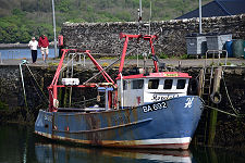
A pier was built to expand the harbour's capacity in 1816. Local industry expanded to include the production of sailcloth and ropes, and shipbuilding also took place. At the start of the 1900s Garlieston Harbour's rail connection meant that special excursions could arrive on the quayside, allowing passengers easy access to steamers bound for the Isle of Man. The railway closed completely in 1964, but the Isle of Man excursions had already ceased in the 1930s.
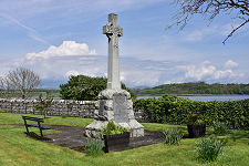
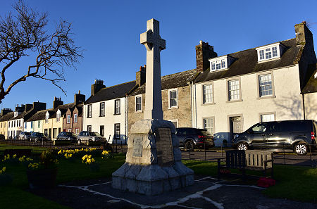
Garlieston Village Hall backs onto Garlieston Bay. Next to it is a large polished stone commemorating an unexpected part of Garlieston's history. During World War Two Garlieston Bay was used to test components of the "Mulberry" floating harbours that were so vital to the success of the D-Day landings in Europe in 1944. Traces of some of these components can still be seen washed up on the far side of Garlieston Bay and elsewhere on nearby shorelines. (Continues below images...)
 War Memorial in Early Morning Light |
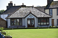
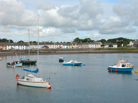
 Bowling Green and Garlieston Bay |
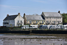
In more recent years Garlieston has become less significant as a commercial port. If you take the interesting walk around the south side of the bay to the harbour you will probably still find the odd fishing boat moored at the quayside. When we originally produced this page in 2003 we commented: "But the harbour buildings show obvious signs of having seen better days: giving a strong sense of a real opportunity for some attractive redevelopment." Someone has since done exactly that, and there has since been significant redevlopment of the harbourside area for residential use.
Despite this, Garlieston remains an important centre for yachting and other leisure craft and today the village's main role is as a resort. To this end the area between the south end of the village and the harbour now has an attractively and conveniently located Caravan and Motorhome Club site.
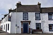
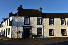
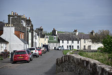
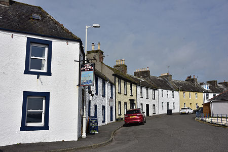
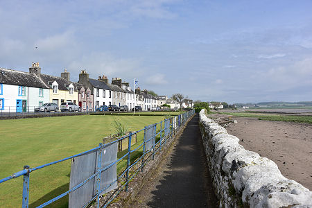
Garlieston still strongly reflects the regular street plan originally laid out by Lord Garlies in the 1780s. North and south of the bridge over the burn as it flows into the sea, a line of attractive cottages runs parallel to the beach. On the south side this leaves room for the village bowling green to be placed on what as a result becomes an attractive promenade. Nearby are The Harbour Inn and The Hive, a cafe. Both are excellent.
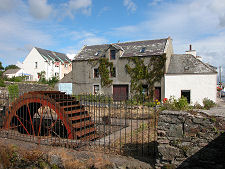
Further streets form a grid and the overall effect is both pleasant and, in the right light, very photogenic. On the north side of the burn near its outflow is a water wheel, a relic from earlier days when economic activity revolved around the port and the mills in the village.
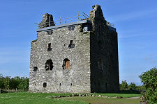
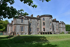
South of the village is the parkland around the private Galloway House, complete with the tranquil Galloway House Gardens, which are open to the public. On the rocky shore three miles to the south of Garlieston are the ruins of Cruggleton Castle, a defensive site dating back to the iron age and once occupied by a castle with no fewer than eight towers. In the Wars of Independence it was captured by Edward I of England before being retaken for Scotland by William Wallace, and it later saw military action well into the 1500s before being abandoned as a ruin in 1680. It was then quarried for its stone. A few hundred yards inland from the castle ruins is the very spooky Cruggleton Church. 1.5 miles west of Garlieston is Sorbie Tower, being restored by the Clan Hannay Trust.
 Garlieston from the Harbour |

|
|
|
Visitor InformationView Location on MapWhat3Words Location: ///folders.flick.shields |
Garlieston In Fiction
|
 Friend or Foe? by Ken Lussey (14 July 2025).
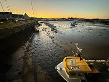 Harbour at Dusk |
 Hopeful 1 |
 The Pier |
 Harbourside Redevelopment |
 More Redevelopment |
 Caravan Site |
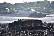 Mulberry Harbour Remains |
 Galloway House (Private) |
 Door Dated 1764 |