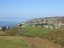
 Gairloch from the East |
See Gairloch and you've seen the Highlands. Well, it's obviously not as simple as that, but there is more than an element of truth in it. Because Gairloch can offer a little of everything that visitors come to the Highlands to see. A typically strung out highland village linked historically to the sea; a superb and complex coastline that is both rocky and sandy by turn; islands; lochs; and views that include some the the best mountains anywhere.
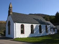
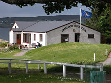
As a settlement, Gairloch has a number of separately named and distinct points of focus. The most southerly is at Charlestown where you can find Gairloch's harbour. This is the subject of a separate Feature Page. From here the road makes its way past Gairloch Golf Club, where a car park also gives access to a beautiful beach. Nearby are two churches, the brown stone Free Church with its magnificent views over Loch Gairloch and the white-harled kirk on the inland side of the main road.
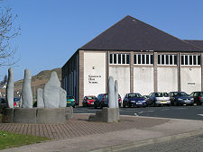
Moving north along the A832 you pass the Gairloch Museum, which opened in new premises in 2019.
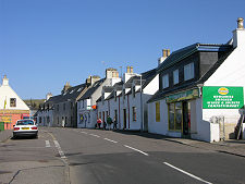
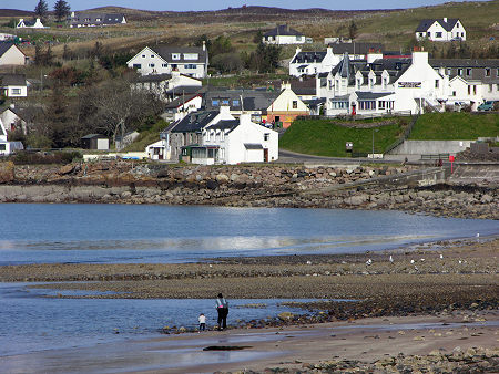
Half a mile round the northern side of Loch Gairloch brings you to Strath, which blends seamlessly with Smithtown. Here you will find the main commercial centre of Gairloch, complete with a range of shops and B&Bs, and a hotel. Here, too, you will find an excellent campsite, in a field located above the coastal road and offering truly magical views.
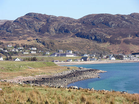
And Gairloch's views are amongst its major assets. They take in the expanse of Loch Gairloch and its complex southern shoreline; and from some vantage points you can also see Longa Island, on the north side of Loch Gairloch where it meets the open sea.
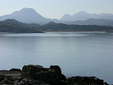
Inland, your attention is drawn by the hills and mountains to the east, towards Loch Maree: and beyond it to one of Scotland's last great wildernesses, the Fisherfield Forest. Further south the views extend to take in the peaks of the Flowerdale and Shieldag Forests and, in particular, a "rear" view of Beinn Alligin, the most westerly of the Torridon giants. Incidentally, don't think the liberal sprinkling of "forests" implies a wooded landscape. There are few trees to be found in these mountainous, lochan strewn areas.
The views are equally striking but very different in the coastal area to the west of Gairloch, where the B8021 continues to Melvaig and beyond. South of Gairloch, the B8056 leads to more fine views from the village of Badachro and the beach at Redpoint.
Gairloch's history dates back at least as far as the iron age dun or fort on a headland near the golf club. A thousand years later the loch was used as a haven by Vikings. Very little remains of them except place names and folklore. Norwegian rule of Scotland's western seaboard ended after the Battle of Largs and King Håkon IV's retreat to Orkney in 1263, and for the following two centuries two clans, the MacLeods and Mackenzies fought for dominance of the area. See our Historical Timeline.
In 1494 King James IV granted the lands to the Mackenzies, who managed their estates from Flowerdale House, a little inland from Charlestown. And they still do: much of the area remains in the ownership of the family.
 Gairloch from the West |

|
|
|
Visitor InformationView Location on MapWhat3Words Location: ///classed.clearcut.boosted |
 Gairloch High School |
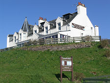 Millcroft Hotel |
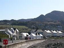 Strath Bay |
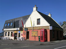 Village Shops |