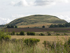
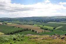
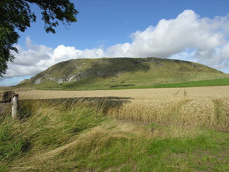
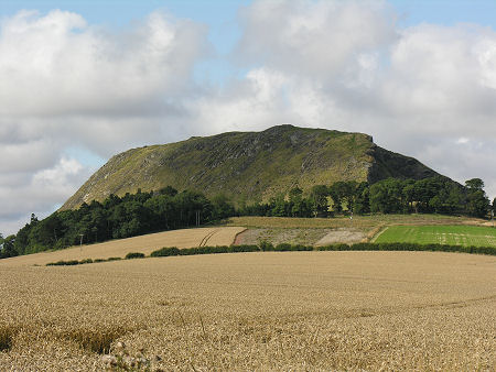
 Traprain Law from the South-East |
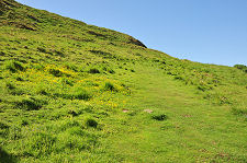
No-one who has ever driven along the A1 trunk road towards Edinburgh through East Lothian can have failed to notice Traprain Law, a whaleback lump of volcanic rock that rises to 221m or 724ft and dominates the views in every direction. You reach it on minor roads that head east from Haddington or south from East Linton. Access is from a parking area on the north side of the Law. From here the path heads west along the south face of the Law, then curves round to the east.
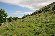
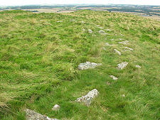
As you reach the higher levels of the south side of Traprain Law, the path passes through what seems to be the remnants of a stone wall. This is actually part of the stone facing for a turf rampart that once surrounded an area which, at its maximum extent, measured some 12 hectares or 30 acres and was large enough for a significant settlement. The rampart itself was 1.07km long.
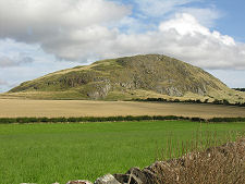
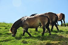
On our most recent visit Traprian Law was home to a herd of ponies, which certainly made a change from the sheep that are more usually encountered in upland areas.
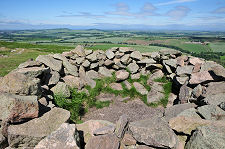
The top of the Law is home to a trig point and a modern low stone shelter obviously intended to protect visitors from the wind. But as you look around, you begin to appreciate a number of other features, including the base of a stone wall that apparently encircled a large oval portion of the summit, and lines of ridges that could easily be - and are - further defensive ramparts. (Continues below image...)
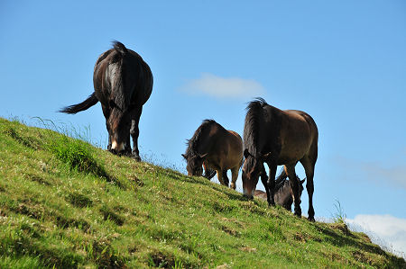 Ponies on Traprain Law |
Traprain Law was first occupied as long ago as the Bronze Age, in the centuries around 1500BC. Bronze tools were made here, and people were buried here. What isn't clear is whether the Law was permanently settled at this time, or just used as a temporary or seasonal encampment. Fast forward to the later centuries BC, and it seems that Traprain Law was serving as the capital of a tribe called the Votadini who controlled a large part of south-east Scotland. Their existing defences at Traprain seem to have been strengthened shortly before the Roman invasion of Scotland in AD80. In the event, however, the Votadini appear to have become a client kingdom of the Romans, assisting them during their periods of occupation of southern Scotland, and acting as a buffer during periods when the Romans had pulled back beyond Hadrian's Wall.
This relationship may well have continued until the Romans' eventual withdrawal from Britain: or perhaps not. In 1919, archaeologists unearthed a hoard of Roman silver hidden on Traprain Law. This weighed 53lb or 24kg and largely comprised cut up and flattened Roman silver tableware apparently dating back to fairly late in the period of Roman occupation. Depending on your point of view, this could be seen as evidence that payments made by the Romans to the Votadini, by now probably known by the Brythonic version of their name, the Gododdin, continued until a very late date. Or it could be seen as an indication that as Roman Britain crumbled, the Gododdin were joining other tribes in mounting raids into Roman-controlled areas and returning with plunder.
Opinions also differ about the point at which large scale occupation ceased on Traprain Law. Some think it remained in use by the Gododdin until the Angles of the Kingdom of Northumbria arrived in the mid 600s: while others feel that by then they had moved their capital from Traprain Law to Edinburgh.
Only two people who lived on Traprain Law during some 2,000 years of occupation have ever been given names. According to the Life of Saint Mungo written by an English monk six centuries later, in about 528 the King Loth of the Gododdin, after whom Lothian was named, ruled from Traprain Law. His daughter Princess Theneva (or Denw) fell pregnant after an illicit encounter with her cousin, the young King Owain of North Rheged, now part of Galloway. King Loth responded by having Princess Theneva tied to a chariot and launched off Traprain Law. She miraculously survived, and the Gododdin, now believing her to be a witch, cast her adrift in a coracle on the River Forth. She drifted up-river and came ashore at what is now Culross in Fife where she was taken in by St Serf. Here she gave birth to a son, who went on to become St Mungo, also known as St Kentigern.
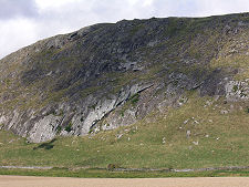
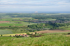
 Traprain Law from the East |

|
|
|
Visitor InformationView Location on MapGrid Ref: NT 582 747 What3Words Location: ///refilled.displays.wing |
 Ponies on Traprain Law |
 Remains of a Curved Wall |
 Summit Shelter |
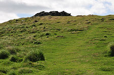 Approaching the Top |
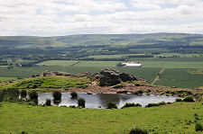 View of the Pond |
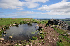 Beside the Pond |
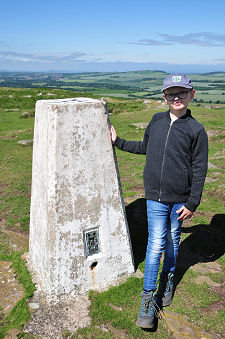 Trig Point |