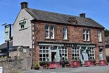
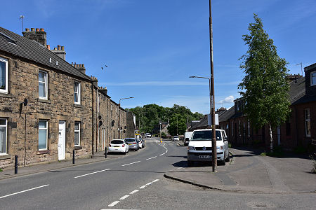
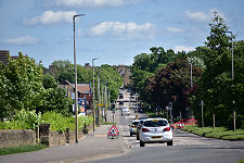
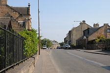
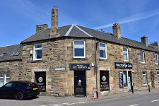
 Main Street from the West |
Winchburgh is a village - rapidly becoming a town - standing close to the eastern boundary of West Lothian. Its Main Street once formed part of the main route, then designated the A9, from Edinburgh to Linlithgow and Stirling. That all changed when a the M9 was built to the north in 1970, and a little later a new runway was built at Edinburgh Airport which cut the line of the old road. This explains why what is now the B9080 to the east and west of the village appears much larger than needed for the traffic it carries.
A location 10 miles from Edinburgh on one of the most important roads in Scotland helps explain why Winchburgh has an ancient history which saw it first mentioned in the records in 1189. The name probably comes from the Old English for "Winca's Fort", and suggests the village may have stood here since being founded by someone called Winca during the period of Anglian or Northumbrian dominance of the area in the 600s.
There is no sign of Winca's Fort today, nor of the village that stood here in 1314 when the English army that had been defeated at the Battle of Bannockburn and then their Scottish pursuers both passed through in the immediate aftermath of the battle. The first surviving evidence of development comes in the form of two rather later castles near the village. (Continues below image...)
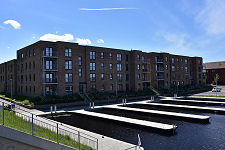
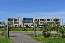
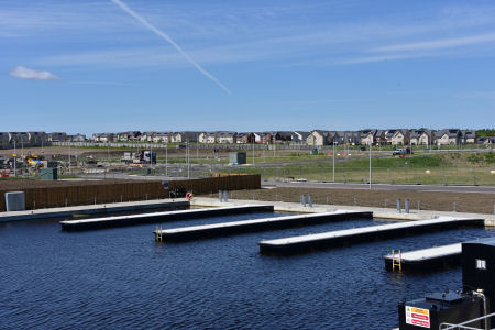 Canal Basin and New Town - A Work-In-Progress |
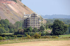
Niddry Castle stands just a third of a mile south-east of the edge of Winchburgh, though much of the area between them is covered by a huge oil shale bing, and by the Niddry Castle Golf Club. The castle is reached indirectly via minor roads to the south. Niddry Castle dates back to the 1400s and was a base of the Seton family, better known for their estates in East Lothian. The most famous resident, briefly, was Mary Queen of Scots, who stayed here on the night of 2 May 1568 after her escape from Lochleven Castle. The castle was abandoned in the 1700s. It has since has been restored, a process that was still underway at the time we took the photo of it for this page.
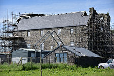
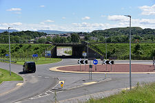
The second castle near Winchburgh is Duntarvie Castle, which stands just under a mile north, and was built by the Durham family in the early 1600s. This remains a work-in-progress but is open for exclusive use. Its outlook has been changed significantly with the building first of the M9 Motorway and much more recently of a junction on the motorway intended to serve the rapidly growing Winchburgh.
Quarrying began to take place to the east of Winchburgh in the 1790s, and in 1822 the Union Canal was built along a line that took it immediately to the west of the village. Winchburgh gained a railway station in 1842 when the Edinburgh and Glasgow Railway was built, using deep cuttings to the north and south of the village and a tunnel running beneath the centre of it. On 13 October 1862, 15 people were killed when two trains collided head on in the cutting a mile and a half north-east of Winchburgh.
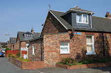
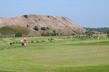
In the 1860s oil shale began to be mined in the area, and in the 1870s an oil extraction plant was established to the south of Winchburgh. At the beginning of the 1900s a new extraction plant was built, known as the Niddrie Castle Oil Works. Its owners, the Oakbank Oil Company, built over 200 new cottages in Winchburgh to house the workers, and the oil works was linked by narrow gauge electric railway to a number of oil shale mines in the area. The Niddry Castle Oil Works was the last producer of oil from shale in Scotland when it closed in 1960. Today the signs left by the industry on the landscape remain very obvious in the form of large red bings or spoil heaps.
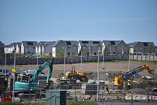
Today's Winchburgh is well placed to take advantage of employment opportunities in Edinburgh and Livingston, and this is reflected in large-scale housing and associated development to the north, west and east of the village; plus new shops, schools, a canal basin and the and already mentioned new motorway junction on the M9. Meanwhile the rows of red brick cottages built in the early 1900s are unusual and give the less frequented parts of the village considerable charm. There is also a range of facilities including a golf club and a bowling club.
 Rows of Shale Miners' Cottages built by the Oakbank Oil Company |

|
|
|
Visitor InformationView Location on MapWhat3Words Location: ///replied.crafts.persuade |
 Approaching from the West |
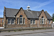
 Sinclair Academy |
 Fields Becoming Houses |
 Main Street from the West |
 Main Street |
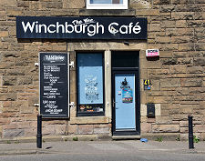 Wee Winchburgh Cafe |
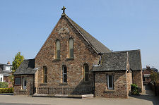 St Philomena's Church |
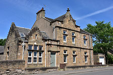 Old Police Station |
 Drainpipe Detail, Police Station |