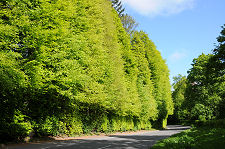
 The Meikleour Beech Hedge from the North in June 2021 |
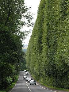
Towering over the A93 main road four miles south of Blairgowrie and ten miles north of Perth is what has, since 1966, been officially recognised as the tallest and longest hedge on Earth.
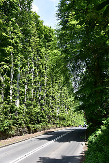
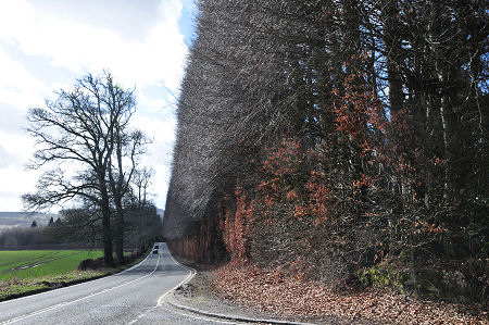
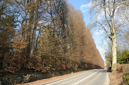
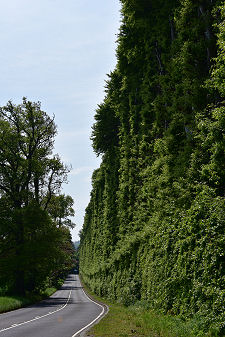
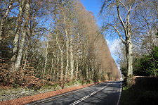
The Meikleour Beech Hedge is 580 yards (or 530m) long and ranges in height from at least 120ft (36m) at its northern end to at least 80ft (24m) at its southern end. The average height is over 100ft (30m). The hedge is made of beech, (Fagus sylvatica) and is cut and measured by the Meikleour Trust, a process that takes four men six weeks using a hydraulic lift and hand-held cutting equipment.
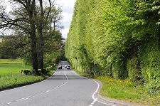
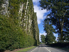
The photo on this page taken in 2000 shows the hedge after it had been cut earlier the same year. Traditionally, the hedge was cut every ten years, but the rising costs of the cutting and of the traffic management meant that it wasn't cut in 2010. The subsequent growth can be seen in photos on this page taken in May 2013 and March 2017. When the hedge was cut in 2019 the cost was £90,000. The effect can be seen in the photos on this page taken in June 2021. (Continues below images...)
 The Meikleour Beech Hedge from the North in July 2008 |
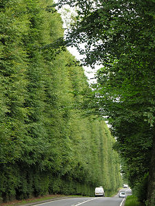
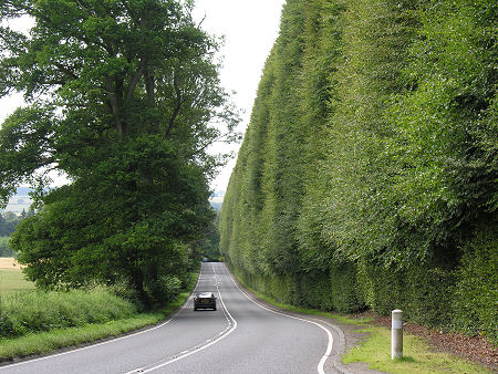
 Seen from the North, March 2017 |
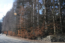
Some of the photos on this page show the very different appearance the hedge takes on in winter, when the leaves turn brown. Because, presumably, of its height and its exposure to wind, the hedge retains its leaves less well than domestic sized beech hedges, giving a very transparent appearance until the new growth begins in the spring.
The story of the hedge is closely associated with the story of Meikleour House, which lies half a mile to the west and whose eastern boundary it defines. The house was built by Robert Murray Nairne and his wife Jean Mercer of Meikleour, heiress of the estates of Aldie and Meikleour, who had married in 1720. The house itself was remodelled into the form of a French château in 1870, but by then its most outstanding feature was already well established.
The Meikleour Hedge was planted by Robert and Jean in the autumn of 1745. However, as Jacobites sympathisers, they would never see it grow to maturity. By the time the hedge was planted, Bonnie Prince Charlie had been on Scottish soil for over a month. The 1745 Jacobite uprising came to a decisive end at the Battle of Culloden on 16 April 1746. Amongst the Jacobites killed in at Culloden was Robert Murray Nairne, and following the battle Jean Mercer left Meikleour to seek refuge and anonymity in Edinburgh.
Visitors to the hedge should not overlook the very pretty village of Meikleour, half a mile to the north-west and reached along a minor road that leaves the A93 at the northern end of the hedge.
 The Hedge from the South During Winter, March 2010 |

|
|
|
Visitor InformationView Location on MapGrid Ref: NO 162 388 What3Words Location: ///canal.schooling.class |
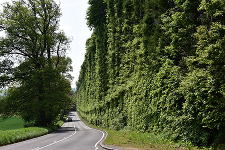
 Seen from the North, June 2021 |
 Seen from the South, March 2017 |
 Another 2008 View from the North |
 Hedge from the North in May 2013 |
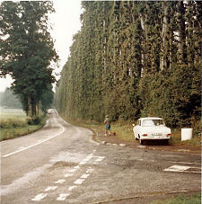
 The Hedge in September 2000 |
 The Southern End and Layby, 2008 |