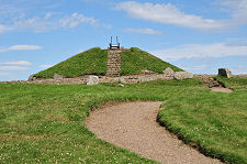
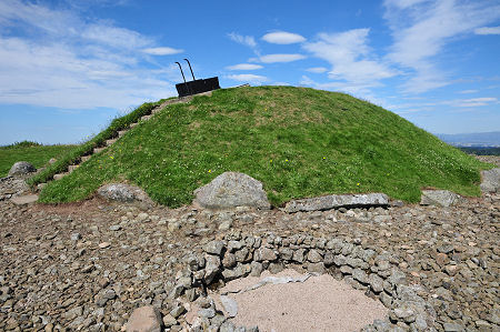
 Cairnpapple Hill Cairn from the East |
Cairnpapple Hill is one of the most important prehistoric sites on mainland Scotland. At about 310m or just over 1,000ft in height, the hill offers one of the best viewpoints in central Scotland, with views extending from Arran in the west to North Berwick Law and Bass Rock in the east. For over 5,000 years this has been a special place, and evidence of this has been on view since excavations in 1947 and 1948.
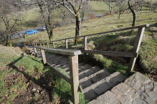
You approach Cairnpapple Hill from the minor road to the east of the site. Stone steps and a grassy (and sometimes slightly muddy) fenced path lead from there to the summit of the hill. This, along with the steps up to the top of the cairn and the short ladder used for access to the interior, mean that accessibility can be an issue. When you arrive, you find the cairn, a small reception and visitor centre, and a nearby radio mast that slightly intrudes on the feel of this special place.
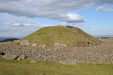
The most important feature today is the cairn that lies at the heart of the complex. This is actually a concrete reconstruction put in place after excavation. But the cairn this replaced was far from the earliest or the most important monument to have been constructed on Cairnpapple Hill.
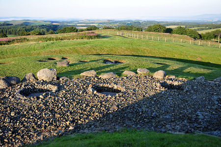
Some 5,000 years ago, in around 3000BC, our Neolithic ancestors built a henge here. This was made up of a circular ditch about 1m deep surrounded by an earth bank 1.2m high, probably intended to screen the interior from view. Within the ditch was a ring of 24 large wooden posts. The finished henge would have looked a little like the stone henge at the Ring of Brodgar in Orkney: but being less durable than stone the wooden posts have long since disappeared, leaving only the holes in which they stood. (Continues below images...)
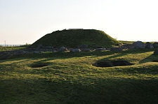
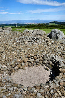
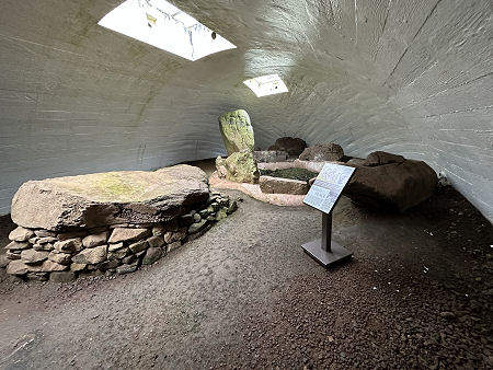 Wide Angle View of Interior |
 Wide Angle View of Interior |
Since the site's excavation the ditch can be traced round much of the henge, and parts of the bank are also visible, though not to anything like its original height. Also visible are the excavated henge post holes, identified by pink gravel.
By about 2000BC the henge had fallen out of use. Around this time the local community sited an important burial near the centre of the ring, which they covered with a small cairn of stones. Some time later two more burials were added nearby in stone cists. These were covered by a much larger cairn that extended over the original burial cairn.
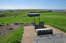
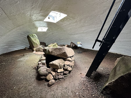
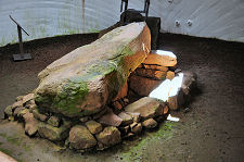
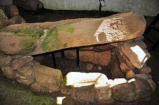
The footprint of the second, larger, cairn was used when a concrete cover was built for the burials in 1949: though this is probably much taller than the cairn it imitates. Having called in at the hut that serves as a visitor reception you enter the modern cairn via a short ladder that descends from its roof.
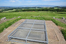
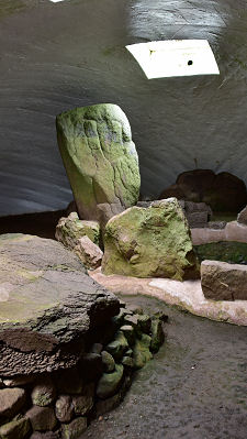
Inside you find the preserved remains of the original grave, known as the north grave, and one of the later cist graves. On a day when a gale is whipping across the top of the exposed hill, the atmosphere inside the cairn is remarkably tranquil.
Back outside the cairn there are two other sets of features that add further layers to an already complex picture. Some of the largest holes on the site lie within the stone covered area close to the base of cairn. These are thought to have been post holes, possibly supporting a screen used at about the time of the north burial. Their current impressive size is misleading.
The most recent features on the site are the traces of four late burials to the east of the cairn. These probably date back to the early Christian era in around 400AD. Cairnpapple lies only a mile east of the much more sheltered site in the village of Torphichen where St Ninian founded a church, also in about 400AD.
One theory suggests a continuity of use over 5,000 years that started with the henge and later burials before moving to the original chapel and then the subsequent churches in Torphichen. There is certainly evidence that suggests a link between the sanctuary stone in the kirkyard at Torphichen and a stone unearthed at Cairnpapple.
 The View East from the Cairn in Evening Light |

|
|
|
Visitor InformationView Location on Map4 Star Historic Attraction. Tel: 01506 634622. Grid Ref: NS 987 717 www.historicenvironment.scot HES: Cairnpapple Web Page Opening Hours Admission Accessibility What3Words Location: ///wishing.grub.sunset |
Cairnpapple Hill In Fiction
|
 The High Road by Ken Lussey (15 September 2023).
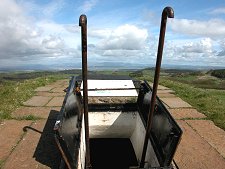 Entrance to the Cairn |
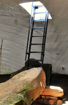 The Ladder |
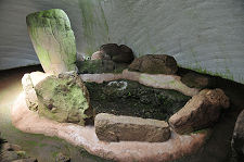 The North Grave |
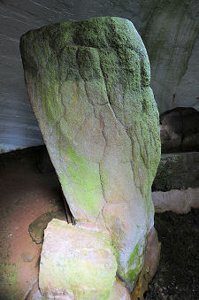 Upright Stone |
 South Grave |
 Another View of the South Grave |
 Steps from the Road |