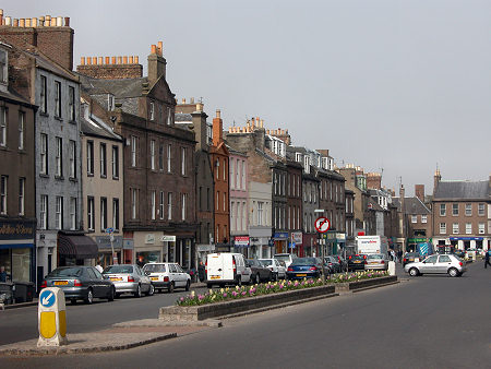
 Montrose High Street |
Montrose is a busy east coast town with something for everyone. Much of the town lies on a spit of sandy land a mile wide that extends southwards across the seaward side of the Montrose Basin, almost cutting this large tidal nature reserve off from the North Sea.
Montrose's origins lie two miles to the west of today's town, on the west shore of Montrose Basin in Old Montrose. This probably served as the port for Brechin until a Viking raid in 980 largely wiped it out.
The replacement settlement was formed on the sandy spit where it has grown ever since. The north side of the River South Esk offered deep water whatever the state of the tide, and the town that grew here was given a Royal Charter by David I in the 1100s.
By 1180 there was a royal castle at Montrose, and a ferry plied between the town and Ferryden on the south side of the River South Esk. The castle was destroyed by William Wallace in 1297 and no trace of it remains.
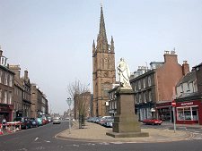
Despite the occasional attentions of other passing armies in later centuries, Montrose grew steadily in size and importance. Today you can think of it as six fairly distinct areas. The core of the town is its High Street, aligned north-south and home to most of its shops as well as to a collection of fine buildings like the library, the Town House, and Montrose Old Church with its landmark 220ft spire erected in 1834. In Market Street is the studio of William Lamb, preserved in memory of the sculptor as a museum.
To the west of the High Street is the line of the main railway north to Aberdeen which, with Montrose Station, arrived in 1850. Beyond the railway is Montrose Basin, which hems in the town from this side. Proposals to reclaim half of the basin in the 1670s got as far as building an embankment across it, Dronners' Dyke, still visible, before the idea was abandoned after storm damage. More recently this part of town has become the location of Montrose's main supermarket and of an inner bypass taking through traffic away from the often very busy High Street.
East of the High Street is an interesting area characterised by open spaces, the Mid Links, in which you find bowling clubs and the town's football and cricket grounds, as well as Montrose Academy.
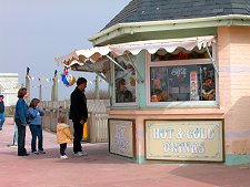
East again and you come to the open, largely grassy areas lying behind the dunes, which in turn lie behind Montrose's excellent beach. Here are the town's camping and caravanning site, the golf courses, and a range of attractions such as the Traill Pavilion that bring a genuine seaside resort feel to this part of town.
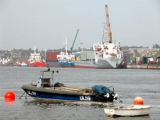
The fifth area of Montrose is found to the south, on the banks of the River South Esk. This is the location of Montrose's busy harbour, which has steadily grown over the past 900 years. Montrose has at different times been an important centre for various types of fishing, from salmon to whaling and herring, and including, for a time, a pearl fishery in the river itself. It has also been an important timber port, and for many centuries was one of Scotland's largest exporters of wool. Today it also benefits from harbour activity connected with the North Sea oil industry.
The River South Esk is crossed at the mouth of Montrose Basin by road and rail bridges. Until the late 1700s the only way of crossing the river was by ferry. A wooden bridge known as the "Timmer Brig" was built in 1795. This was replaced in 1829 by a suspension bridge designed by Captain Samuel Brown, RN, best known for the Union Chain Bridge across the River Tweed nine years earlier. This collapsed through overloading with the loss of three lives in 1830. It was rebuilt, only to be damaged in a storm in 1838. The suspension bridge was replaced by a concrete road bridge in 1930, which was itself replaced by the structure you see today in 2006.
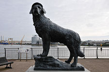
Not far from the bridge and on the bank of the river is a statue of Bamse (Norwegian for "Teddy Bear"), a St Bernard who lived on the Norwegian minesweeper Thorodd during World War Two, and who achieved considerable local fame.
The final area of Montrose lies to the north of the centre of the town, as the main road starts to lead towards Aberdeen. Now increasingly given over to housing development this was once an important industrial area. Close by is the site of Britain's first operational military airfield, established by the Royal Flying Corps at the end of 1913, and reopened in WWII. Part of it is now home to the Montrose Air Station Heritage Centre.
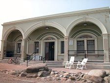
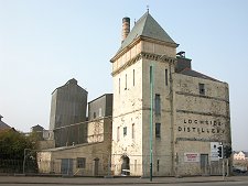
Throughout the 1900s the north end of Montrose was dominated by the tower of Lochside Distillery. This wonderful structure was unique in Scotland and owed much more to the architectural traditions of German breweries than those of Scottish distilleries. The building is, sadly, now only a memory. Head west from here, however, and the treatment of our heritage gets rather better. Two miles beyond the edge of Montrose is the House of Dun, built in the 1730s and restored to its former glory in the late 1980s. It is now open as a visitor attraction.
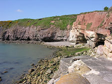
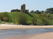
The coast south of Montrose is superb, with highlights including the magnificent Lunan Bay, with over two miles of broad, dune-backed sand, and the rather craggier Boddin Point. High on a bluff and dominating the centre of Lunan Bay are the very red remains of Red Castle.
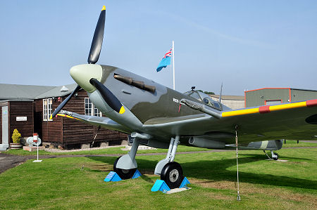 Montrose Air Station Heritage Centre |

|
|
|
Visitor InformationView Location on MapWhat3Words Location: ///recap.bills.trek |
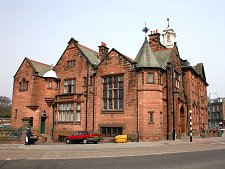 Library |
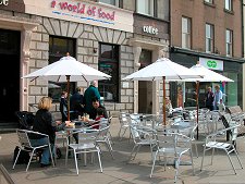 Street Cafe |
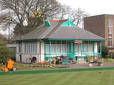 The Melville Bowling Club |
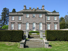 The House of Dun |
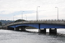 The Bridge Opened in 2006 |
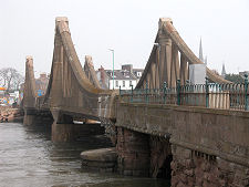 Old Montrose Bridge, Now Replaced |
 Disused Lochside Distillery in April 2003 |