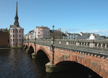
 Ayr and the New Bridge |
With a streetplan dating back to the 1200s and many fine buildings from the centuries since, Ayr is an attractive town with a real sense of its history. When you add a river that was first bridged 800 years ago, a harbour that for centuries was the most important on the west coast of Scotland, a racecourse dating back (on an earlier site) to 1770 and all the trappings of a seaside resort, you end up with a town that has something for everyone.
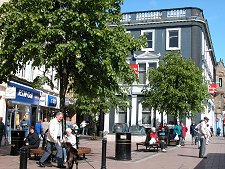
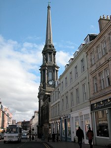
Originally known as St John's Town of Ayr or Inverayr, Ayr started life as the settlement serving a castle built here in 1197 by William I (see our Historical Timeline). This was border country at the time. Galloway, to the south, only securely became part of Scotland during Alexander II's reign in 1234. Ayr's origins were as an L-shaped settlement, with Sandgate marking the western line beyond which the sand dunes threatened to inundate the town, and High Street running inland, parallel to the River Ayr.
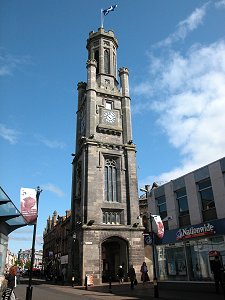
This pattern persists and today the junction between these two main streets is home to Ayr's most prominent landmark, the spire of the Town Hall, built in the years to 1832.
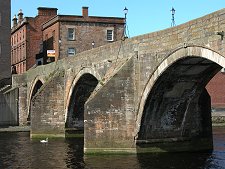
For a while the River Ayr was probably crossed by a ford. As early as 1250 a timber bridge had been built a short distance upstream of the ford. This was rebuilt in stone in 1470 and remains standing today, open to pedestrians. For many the Auld Brig is one of Ayr's most distinctive features. In 1788 a "New Bridge" was opened on the line of the original ford. This first New Bridge was washed away in flooding in the 1870s and the Auld Brig once more became the main crossing until a replacement New Bridge could be built in 1878.
Ayr's wharves and quays originally lined the river itself. By 1300 it was Scotland's main west coast port, a role it maintained until overtaken by Glasgow several centuries later. Early coastal trade was later supplemented by links to Ireland, Europe, and the Americas.
By 1777 over 300 ships were using the port each year. At this time Ayr was serving as the nautical equivalent of the distribution centres you see round motorway junctions today. Commodities like tobacco from America, slate from Easdale, earthenware and bottles from England and salt from Spain were imported in bulk and then shipped to all parts of Scotland's western seaboard. The presence in Ayr of Scotland's largest wine merchant at the time, Oliphant & Co, also greatly helped the town's trade. Today Ayr retains a large harbour, to the north of the mouth of the river.
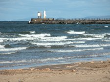
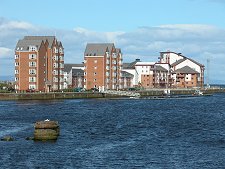
The old harbour area to the south of the river has recently seen high quality residential development. This makes the most of the river frontage, and also exploits its position at the north end of the long stretch of beach that allowed Ayr to become a highly fashionable resort from the early 1800s. Its popularity was initially based on steamer services, but the real boom came from 1840 when the railway linked Ayr and nearby Prestwick with Glasgow.
Nothing remains of the castle built by William I. After an eventful early life, it was demolished by Cromwell's forces in 1654 to make room for the huge citadel he built here, and from which they governed much of Scotland. Much of the Citadel's outer wall remains in place, with the higher level interior areas used in the 1700s for residential development. Like the Citadel wall, much else remains on view from Ayr's past. The Auld and (second) New Bridges are very attractive, as are the Town Hall with its remarkable spire and the nearby Wallace Tower, which dates back to 1833.
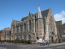
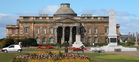
Close to the river and just west of Sandgate is Loudoun Hall, a magnificent restoration of Scotland's oldest merchant's house, built in 1513. Less well known is St John's Tower, all that remains of a church standing within the Citadel, while nearby is the classical frontage of the County Buildings, the town's courthouse dating from 1822.
 County Buildings |

|
|
|
Visitor InformationView Location on MapWhat3Words Location: ///rural.crafted.rust |
 Wallace Tower |
 Auld Brig |
 Sandgate & Town Hall Spire |