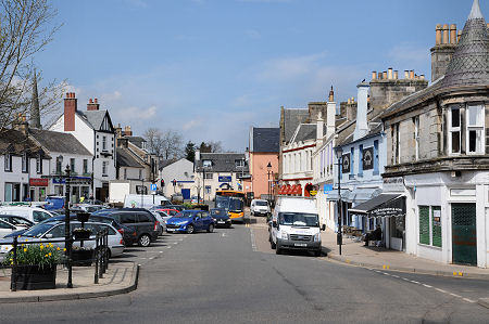
 Common Green |
The town of Strathaven sits astride the A71 Edinburgh to Kilmarnock road some five miles west of its junction with the M74 motorway. The town lies on the north side of the valley of the Avon Water (or Strath Avon) and is built around the Powmillon Burn as it flows towards its confluence with the Avon Water, half a mile to the south.
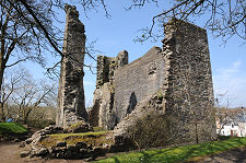
The A71 passes to the south of the true heart of the town, and as a result it is possible to drive straight through without really noticing much beyond the ruined Strathaven Castle, which you pass on your left if you are heading west. Anyone who does simply pass through misses one of the nicest small towns you are likely to find anywhere. Strathaven is a place that amply repays a little exploration, especially when the weather is nice and it is possible to appreciate just how colourful many of the buildings are.
One of the first things any visitor to Strathaven needs to know is how to pronounce the name, which is not obvious from the spelling. It should be pronounced "Stray-ven". The origin is fairly obvious. As already note, Strath Avon is the name of the broad valley of the Avon Water, a river which flows generally north-east to its meeting with the River Clyde near Motherwell. Strathaven was sometimes being called "Strathavon" as recently as the end of the 1800s. Go back rather further and Strathaven Castle, which now dominates the A71, was often known as Avondale Castle, a very Anglicised version of the same name.
The early story of Strathaven follows closely the story of Strathaven Castle. There may have been an older wooden castle on the site, but the first stone castle was built here in about 1350 by the Baird family. It was later owned by the Black Douglases, and it was amongst their castles destroyed by King James II in 1455 when he suppressed this branch of the Douglas family. Strathaven Castle was rebuilt in 1458 by Sir Andrew Stewart, 1st Lord Avondale. It later passed to the Hamilton family, but fell into disuse and disrepair after being abandoned in about 1740.
Early Strathaven grew up servicing the castle, though until the main road was rerouted past the front of the castle in 1826, it stood in grounds that extended a little to its north. The town became a burgh, which conferred the right to hold a market, in 1450. By the middle of the 1700s Strathaven stood at the centre of a web of roads that are closely followed by the modern road network, and five fairs were held annually.
The river provided power for a textile mill, and hand loom weaving and silk manufacturing were important sources of employment in the 1700s. In the early 1800s the town acquired a post office, a brewery, a gas works and a number of factories. The railway arrived in 1863, and departed just over a century later.
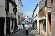
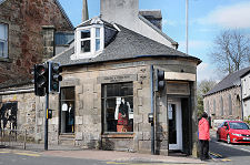
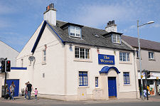
The town itself is remarkable for the number of brightly harled or pebbledashed buildings, giving the slightly surreal impression that you are walking through the set of a children's TV series. The overall effect of the collection of pinks, yellows, reds, blues and greens that dot Strathaven is extremely attractive. There is also an impressive collection of pubs on view, including a number that have gone for the brightly coloured approach.
As you look around this extremely well-kept town, you can't help wondering how it maintains such obvious economic vitality. The answer lies further north, in East Kilbride, whose dramatic growth over recent decades has had a positive impact on attractive places to live within easy commuting distance: and on Strathaven in particular.
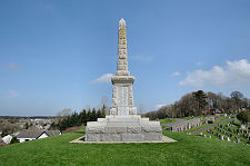
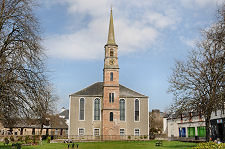
The rock on which Strathaven Castle is built is an excellent vantage point from which to view the town. Another is Kirkhill, to the east, now the imposing home of Strathaven's war memorial. From either, the most significant features on the skyline are two spires. One comes complete with a clock. This belongs to the East Parish Church, superbly located next to the Powmillon Burn at the end of Allison Green. The other is plain stone and belongs to the Rankin Church, a little to the west.
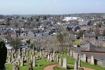 Strathaven From Kirkhill |

|
|
|
Visitor InformationView Location on MapWhat3Words Location: ///atlas.dubbing.vies |
 Bridge Street |
 Kirk Street |
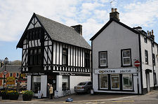 Tudor Coffee House and Opticians |
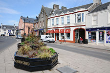 Common Green |
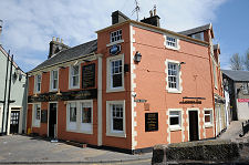 Star Inn |
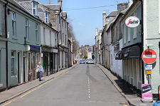 Waterside Street |
