Undiscovered Scotland

  • Home
  • See & Stay
    • Area Main Page
    • Area Hotels & Inns
    • Area GHs, B&Bs, Hostels
    • Area Self Catering
    • Late Availability
    • Area Eating & Drinking
    • Area Info
    • Area Index
    • Local Attractions
  • Discover
    • Site Index
    • A-Z Indexes
    • Categories
    • Find Accommodation
    • Tours & Holidays ▼
      • Tour Operators
      • Walking Holidays and Guiding
      • Wildlife Tours & Holidays
      • Golf Tours and Holidays
      • Motorhome Hire
      • Cruising & Charter
      • Arts, Crafts & Photo Holidays
  • Site Resources
    • Late Availability
    • What's On?
    • What's New?
    • Links Collections
    • Hotel Reviews
    • Scotfax
    • Biography
    • eBooks
    • Book Reviews
    • Bookshop
  • Site Info
    • Contact
    • Site Information
    • How to Feature
    • Website Design Services
    • Twitter: Follow Us
    • Cookies & Privacy
    • Copyright, T & C

Portgordon

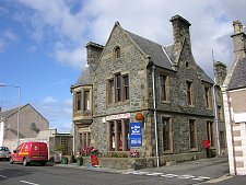
Gordon Square
Gordon Square
 

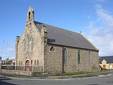
Portgordon, sometimes called Port Gordon, was founded on a greenfield site by the 4th Duke of Gordon in 1797. The signs of its origins as a planned village remain in the broad and attractive High Street, the central square, and the slightly later Church of Scotland contained within the grid of roads.

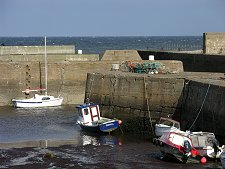
The most important development funded by the Duke of Gordon was Portgordon's harbour. At the time this was the most significant for some distance in either direction along the Moray coast, and it was to remain so for over 50 years.

Portgordon initially grew as a fishing village, though it also imported coal for industries in Moray, and exported their products. In 1857 Portgordon's importance started to wane with the building of a harbour at Nether Buckie (now known as Buckpool) two miles along the coast; a process that was completed with the building of the huge Cluny Harbour at Buckie in 1877. Fishing boats previously based at Portgordon left for the better facilities and market at Buckie. (Continues below images...)

Boats in the Harbour, September 2004
Harbour Mouth Blocked by Shingle, April 2026
 

In 1886 the railway came to Portgordon, dramatically improving the village's links to other coastal communities: it was to close 80 years later in 1968. Perhaps the most surprising event to have taken place at the station was the arrest of two German spies here on the morning of 30 September 1940. They had landed off the coast by seaplane in the early hours of the morning, with a third man who was arrested in Edinburgh. Two of the three spies were later executed in London. The third, Vera Eriksen, was probably a double-agent working for MI6 and simply disappeared, perhaps assuming a new identity.

Portgordon's harbour remained active until badly damaged by a storm in 1953. It was later repaired. Further renovation took place in 2023/4 with a view to operating it as a marina. Unfortunately, prolonged bad weather caused the harbour to be blocked by huge quantities of shingle over the winter of 2024/5, and this remained in place when we last visited in April 2026.

Portgordon serves mainly as a pleasant western outlier of Buckie. Local industry has revolved around a maltings a little to the south of the village, built to service Moray's distilleries.

Despite Portgordon's clear origins, its name has always been the subject of debate. Should it be Portgordon or Port Gordon? The Ordnance Survey goes with the single word variant, which is why we do: but many sources use the two word name. Locals pride themselves that this lack of definition is common both to the name of their village and to the colour of Scotland's flag, the Saltire, whose blue has been rendered in many different shades over history.
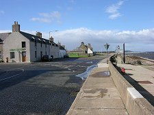
Gordon Street
Gordon Street
   
Clickable Index Map

Visitor Information

View Location on Map
What3Words Location: ///nicer.likely.slip
Blocked Harbour Mouth, April 2026
Shingle Coming Over Pier
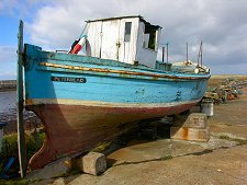
BCK 624
BCK 624
Community Garden
Community Garden
Distance Marker
Distance Marker
The Rock Snake
The Rock Snake
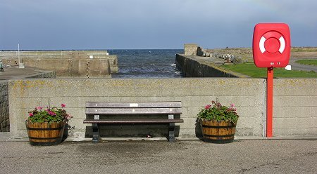
Harbour Barometer
Harbour Barometer
 

Visitor Information

View Location on Map
What3Words Location: ///nicer.likely.slip
Gordon Square
Gordon Square
Community Hub
Community Hub
West High Street
West High Street
Oran House
Oran House
Church
Church
 Stone House
Stone House
Lampie Hoose Cafe
Lampie Hoose Cafe
200th Anniversary Marker
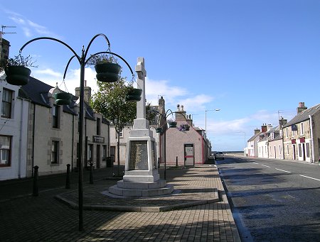
War Memorial
War Memorial
 

Copyright Undiscovered Scotland © 2000-2026