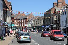
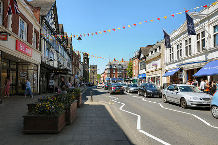
 Bridge Street, Looking West |
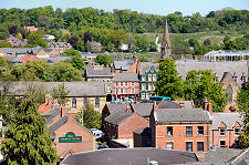
Morpeth, the county town of Northumberland, lies some 12 miles north of Newcastle upon Tyne and just to the east of the main A1 road, which has bypassed it since 1970. What you find today is a thriving place that serves as a hub for a large part of central Northumberland. This can make it very busy at times, and plans are being discussed for a further bypass, this time taking east-west traffic out of the town and onto a new road to be built to its north.
The town centre is surrounded on three sides, the east, south and west, by a broad loop of the River Wansbeck, and the spur to its early development was a crossing here over the river on the main route north, a route which became the A1 Great North Road until that moved to the west in 1970. A slight oddity of the town's layout is that although the centre of the town developed on the north side of the river, many of the important individual buildings, such as the parish church and the castles, were built on the south side. Another is that, almost uniquely in Northumberland, many of the smaller buildings are built in brick rather than stone. This was a fashion that caught on after a major rebuild following a serious fire in the late 1600s, and gives the town a very distinctive appearance.
Although it seems highly likely that there was a settlement here during the Anglo-Saxon period, it only enters recorded history when the Barony of Morpeth was granted by William I to one of his followers, William de Merlay, in about 1080, as part of the Normans' campaign to secure control over northern England in the years following the Norman Conquest. De Merlay's first act would have been to build a castle on the best defensive site he could find. In this case it was on the end of a narrow, steep sided ridge that approached the River Wansbeck crossing from the south-west. The Normans sculpted the ridge to form a distinct "neck" and used the spoil they had created to enhance the hill that stands at the head of the ridge.
The result is today known as Ha' Hill, or Haw Hill, a flat topped, steep sided motte in what is now Carlisle Park, whose top measures some 80m in diameter. The wooden castle William de Merlay built on the top would have controlled the crossing over the River Wansbeck immediately to the north-east, and given him a secure base from which to exert his influence over the wider area. It is unclear whether the lower and narrower area beyond the neck of the ridge was used for a bailey, providing additional accommodation. The castle here was captured by William II, or William Rufus, in 1095. This suggests that de Merlay had joined the rebellion of Northumbrian lords against William that was suppressed in that year.
Nonetheless, the de Merlay's were still in control of the area when Ranulf de Merlay founded Newminster Abbey, a little to the west of the town, in 1138 as a daughter house of Fountains Abbey. In 1200 Morpeth was granted the right to hold a market, and this soon became important in the buying and selling of cattle. Some time in the 1100s, the wooden castle on Ha' Hill seems to have been replaced by a stone one, though this was not enough to withstand King John, who destroyed it during the First Barons' War in 1216.
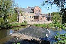
In 1236 the monks at Newminster Abbey were granted land on the Northumberland coast near Blyth, with the right to collect sea coal. Coastal residents had been collecting coal back into prehistory, but this grant is the first historical record of an activity that went on to spawn the Northumberland coalfield, which had huge importance to the economy of the area until recent times, with 59 pits still operational in the county (including north Tyneside) in the 1950s.
Morpeth appears to have been without a castle between 1216 and 1342, when William de Greystock, whose family had inherited the Barony of Morpeth through marriage in 1271, began work on a replacement. The site chosen was a short distance to the south of the Norman castle, again offering a steep drop to the north and the opportunity to command the stone bridge which had been built across the River Wansbeck to replace the earlier ford some time in the 1200s. At about the same time a stone chantry was built at the north end of the bridge. The chantry remains in use as a tourist information centre and museum, and the piers of the medieval Old Bridge are still used to support a more modern footbridge across the river.
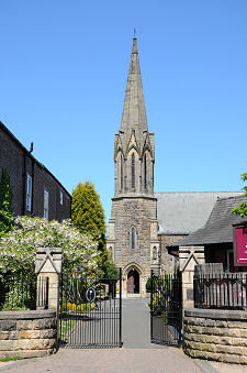
It was presumably William de Greystock who also supported the building of the Church of St Mary in the mid 1300s on a site a little to the south of the new castle and, as a result, some distance away from most of the parishioners living in Morpeth.
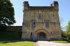
In 1516 Margaret Tudor, widow of James IV of Scotland, and sister of Henry VIII, spent four months in Morpeth Castle while recovering from illness. The castle itself only saw military action once. Although in a poor state of repair, in 1644 it was occupied by a Parliamentary garrison of 500 troops, who held it for 20 days despite the best efforts of James Graham, 1st Marquess of Montrose, and his army of 2,700 Royalists. Over the following two centuries much of the actual castle was removed for building stone, though the gatehouse remains in use as a residence, and the perimeter wall also still stands, though in a poor condition. The castle gatehouse today stands in Carlisle Park and is available as a holiday let from The Landmark Trust.
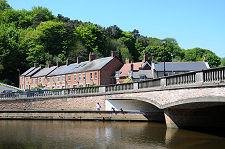
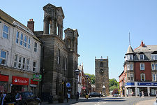
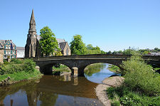
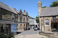
It seems likely that some of the stone from the castle found a new use when the clock tower in Oldgate was built, some time in the late 1600s. The nearby Town Hall was built to a design by the architect Sir John Vanbrugh in 1714. It was damaged by fire in the 1800s and much of the rear of the building was replaced in 1870. Meanwhile the medieval bridge crossing the River Wansbeck on the south side of the town centre was replaced when a new bridge opened in 1831, built by Thomas Telford. This remains in use today.
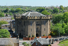
Morpeth courthouse, which stands on the south side of the river opposite Carlisle Park, was built during the 1820s. Anyone wandering the area looking for Morpeth Castle could be forgiven for wrongly thinking they have found it. If the courthouse has an architectural inspiration, it has to be the Tower of London. When we visited work was under way to convert the courthouse into "Morpeth Court" for residential use.
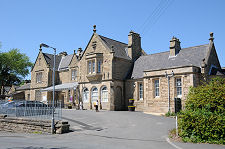
Also on the south side of the river is Morpeth Station, built in 1847 for the York, Newcastle and Berwick Railway, which now forms part of the East Coast Main Line. Immediately to the south of the station is what is regarded as the tightest curve on any main line railway in Britain. In 1877 a train from Edinburgh to London King's Cross came off the rails on the curve, with the loss of five lives. The subsequent inquiry blamed the track layout and called for a new "deviation line" to be built. It never was, and the same tight curve has since been the site of derailments in 1969 (with the loss of six lives), 1984 (causing 35 injuries), and 1994 (with one injury).
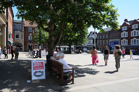 Morpeth Market Place |

|
|
|
Visitor InformationView Location on MapWhat3Words Location: ///hence.jumps.elevated |
 Pizza Express |
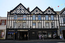 Queens Head Hotel |
 Town Hall |
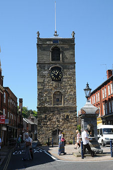 Clock Tower |
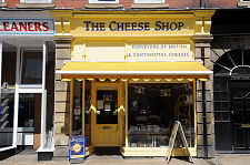 Cheese Shop |
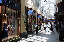 Sanderson Arcade |
 Telford Bridge |
 Chantry Place |