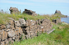
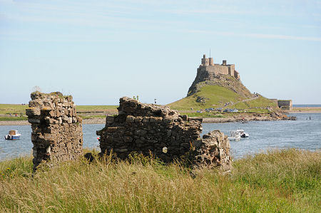
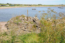
 The Redoubt of the Fort, with the Castle Across the Harbour |
Everyone knows that the Holy Island of Lindisfarne has a castle, and when the weather is fine and the tidal causeway is open, the stream of visitors walking through the village from the car park to Lindisfarne Castle proves just how popular a place it is. Much less well known is that Lindisfarne has a second castle, or the ruin of one, which stands overlooking the harbour at the end of The Heugh, the rocky ridge that acts as a remote tail for the crag on which Lindisfarne Castle stands.
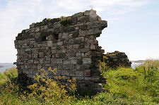
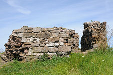
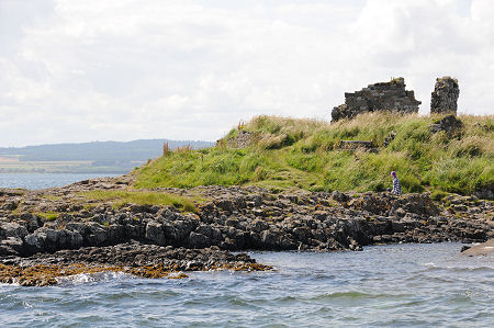
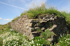
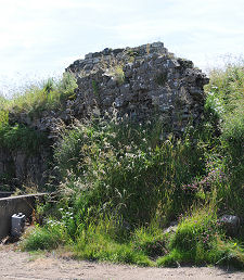
Osborne's Fort is also sometimes referred to as Steel End Fort or simply "The Fort on The Heugh". It is reached by a short clamber from the landward end of Lindisfarne's concrete pier. The nature of the stonework and, in particular, the thickness of the surviving walls, make the defensive purpose of the structure obvious, but the fragmentary nature of the remains mean that it is difficult for the casual visitor to come to any conclusions about when it was built, or how it would originally have looked. Things are not helped by signs of coastal erosion on the south or seaward side of the ruins.
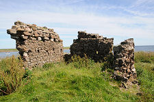
Osborne's Fort was built in 1671 to supplement the defences already offered to Lindisfarne's harbour by the artillery mounted on Lindisfarne Castle. As originally built, it comprised an irregular pentagonal structure, with lower level gun platforms around the south and east sides and a redoubt towards the eastern end. The idea was to ensure that artillery mounted here could command approaches to the harbour and ensure that any hostile vessel would be caught in crossfire by guns based both here and in the castle.
The main evidence of what the fort looked like comes from a painting of 1673, which features Osborne's Fort very much as a background detail. Nonetheless this suggests that there may have been a small tower at the west end of the fort. It also suggests that the redoubt within the fort once reached a height of two or three storeys, and was perhaps topped off by a wall walk. Today all that remains are parts of three sides of the ground floor of the redoubt, plus a few pieces of surrounding wall. Meanwhile, the erosion on the south side has exposed part of a prehistoric midden which suggests the site has been in use for thousands of years.
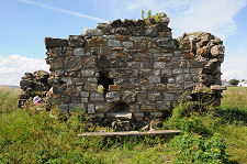
It is not clear why the structure is known as "Osborne's Fort". It was built under the supervision of the governor of Holy Island at the time, Major Daniel Collingwood, who employed a Robert Trollope to undertake the actual construction.
Osborne's Fort appears to have been in use for only a relatively short period. A drawing produced in 1742 shows the perimeter walls already in a state of decay, though at that point the redoubt was still complete. Today the ruins are so fragmentary that we suspect only a very small proportion of the many people who visit Lindisfarne Castle, from which the fort can be clearly seen, ever notice its existence.
 The Fort Seen from the Harbour |

|
|
|
Visitor InformationView Location on MapGrid Ref: NU 130 417 What3Words Location: ///fails.stupidly.loans |
 Another View of the South Wall |
 North Wall and Harbour |
 North Wall Seen from Harbour |