 Portencross from the Harbour |
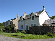
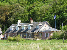
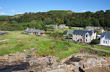
Portencross is easy to overlook. It comprises a tiny collection of cottages, a harbour, a castle, and a pier, and stands at the end of the B7048 a little under two miles west of West Kilbride in North Ayrshire. From its junction with the A78 the road to Portencross is not quite single track in width, but it is narrow enough to induce a slight wince if anyone driving the other way seems to be progressing too enthusiastically.
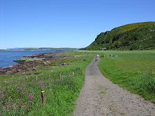
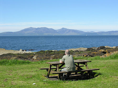
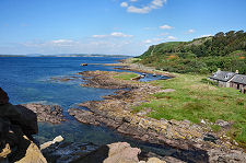
The road to Portencross ends in the village and visitors are recommended to use the car park which you find on your left as you reach the first houses. From the car park you begin to appreciate why Portencross is such a magical spot. It stands at the most westerly point of North Ayrshire, close to Farland Head, and the coastal views are superb, taking in the island of Great Cumbrae to the north, Little Cumbrae and Bute to the north-west, and the Arran to the west.
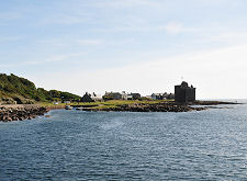
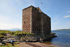
As you wander through the village the most striking feature is Portencross Castle. This stands right on the shoreline only a few feet above the high water mark and for centuries has provided a landmark for seafarers in the Firth of Clyde.
The castle has stood on this spot since the 1300s and was frequently used by King Robert II and his son Robert III. The castle as you see it today is the result of a major renovation project which took place between March 2009 and September 2010. With the very structure of the castle crumbling away, the Friends of Portencross Castle raised over £1 million to bring it back to life including support from The Heritage Lottery Fund, Historic Environment Scotland, and the Architectural Heritage Fund, plus contributions from North Ayrshire Council and many individuals.
Other kings may also have passed by this way. Portencross was said to be the place where the bodies of early Scottish kings were put aboard ships en route to their burial on Iona. A cleft in the rock immediately on the landward side of the castle forms a small harbour "The Old Harbour" that was apparently used for this purpose; though this would have predated the arrival of a castle on its current site by several centuries.
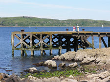
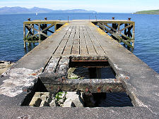
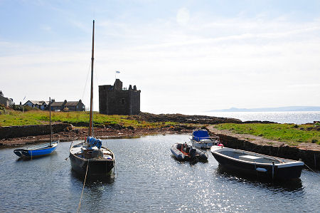
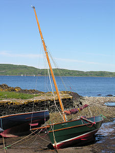
In more recent times a slightly larger harbour has been formed about a hundred yards north of the castle. Dry at low tide, this continues to be home to a number of small vessels. A little further north is a pier built in the Victorian era to service Clyde steamers. Portencross never proved as popular a destination as places like Largs, Fairlie and Wemyss Bay, and at some point the pier fell out of use. Parts of it have since been removed: so while it remains possible to walk out to the end of the pier, anyone doing so has to first skirt a large hole near the landward end.
Although the road ends in Portencross, it is possible to follow the coast north on foot. If you do so you emerge in a part of the world that is about as far away as the peace and quiet of Portencross as it is possible to imagine. A mile and a half from Portencross is the Hunterston Power Station. Invisible from Portencross itself, this comprises two nuclear power stations. Hunterston A operated from 1964 to 1989. Hunterston B opened in 1976 and continues to produce enough power for around a million homes. Hunterston Terminal, a little further along the coast, was built in the late 1970s to handle iron ore for the now long-defunct steelworks at Ravenscraig near Motherwell in central Scotland. The terminal now unloads coal which is moved onwards by train to power stations such as Drax in Yorkshire.
 The View of Arran from Portencross |

|
|
|
Visitor InformationView Location on MapWhat3Words Location: ///pizzas.poet.factored |
 Portencross Castle |
 View from the Castle |
 The Village Seen from the Castle |
 Portencross Harbour |