 Machrihanish |
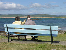
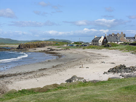
Machrihanish lies five miles west of Campbeltown in a superb location at the southern end of the three miles of magnificent sand and dunes that line Machrihanish Bay and face westwards out into the Atlantic. Many will enjoy Machrihanish because of its seaside location, because of its beaches, because of its rocky headlands, and because of its views. These extend north along Machrihanish Bay to the uplands of Kintyre, and north-west to Islay and the Paps of Jura, 34 miles to the north-west. Head due west from here and you encounter nothing but open ocean until you reach Newfoundland.
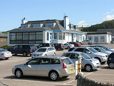
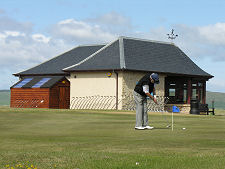
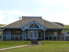
Machrihanish is perhaps best known today for its golf. The Machrihanish Golf Club dates back to a meeting held in the Argyll Arms Hotel in Campbeltown on 11 March 1876. The course which the Kintyre Golf Club (as it was initially called) then established in the dunes behind the southern end of Machrihanish Bay bears the stamp of Old Tom Morris, who redesigned and extended it in 1879 for a fee of £1 per day plus expenses. Actually, to say the course "lies behind" the bay is slightly misleading. The 1st Hole, regarded by some as the best opening hole of any golf course in the world, requires the golfer to drive over part of the shoreline itself en route to the haven of the first fairway. In 2005 the US magazine Golf Digest rated Machrihanish Golf Club as the 39th best golf course in the world outside the USA.
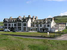
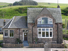
The story of Machrihanish since 1879 has in large part been one of a coastal and golfing resort. By 1906 it was so popular with visitors that an existing light railway was upgraded to carry passengers between Machrihanish and Campbeltown. This allowed Machrihanish to take advantage of Campbeltown's many steamer connections with destinations right across the Firth of Clyde and in the Western Isles. The railway ceased operations in 1932, but by now Machrihanish was well established. The largest hotel in the village, the Ugadale Arms Hotel, was built in 1898 and later became the Machrihanish Hotel before being redeveloped into golfing apartments. (Continues below image...)
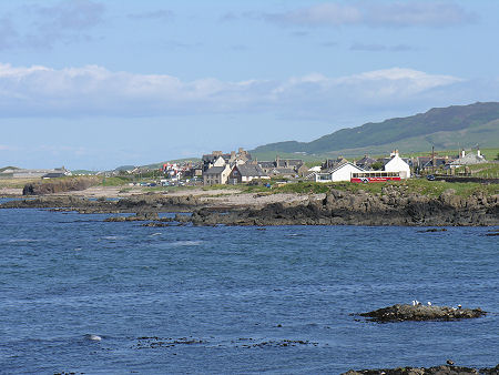 Machrihanish from the West |
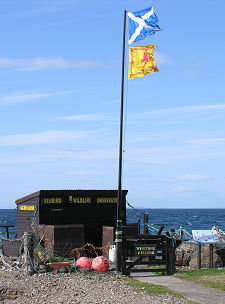
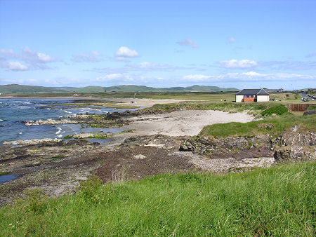
At the west end of Machrihanish a series of low green buildings, close to the old lifeboat station, mark the location of Stirling University's Marine Environmental Research Station. Just beyond it is the Machrihanish Seabird and Wildlife Observatory, which is open to visitors.
Another facet of the story of Machrihanish is less obvious. Just visible from the village, beyond the golf course and the dunes backing the bay, are the rooflines of some of the buildings of what for most of its life was RAF Machrihanish. This started life as a Royal Naval Air Service station in World War I, and reopened in WWII. During the cold War it became an important military airfield whose runway was extended to become one of the longest in Europe. Once a diversion airfield for Britain's nuclear-armed V-Bombers, for maritime aircraft hunting Soviet submarines in the North Atlantic, and during the early testing of Concorde. It later became a base for various US military units until its operational closure in 1995. Today the airfield at Machrihanish sees occasional military visitors, but primarily serves as Campbeltown Airport, offering a service to Glasgow.
Although Machrihanish's life as a golfing resort can be dated back to 1879, the village is actually very much older. It was also, for much of its life, a very much grittier place than you see today, with an economy driven by coal mining. Even before 1500, coal was being mined here and burned under pans filled with seawater along the shore to produce salt. Indeed, the first map which showed anything here, in 1750, named the settlement Mary Pans. By 1785, enough coal was being mined in an around Machrihanish to justify opening a canal linking it to Campbeltown harbour.
The coal appeared to run out in the mid 1800s, but a new pit opened in 1876 and was linked to Campbeltown by a narrow-gauge railway. This was the railway that in 1906 was adapted to carry passengers as well as coal. Some of the coal produced here was shipped out from Campbeltown, but much of it fuelled the large number of distilleries in full flow in the town in the latter parts of the 1800s. Coal output peaked in the early 1900s then declined until the pit closed in 1929, leading to the closure of the railway in 1932. In 1946 a drift mine opened in a further effort to extract the area's coal reserves. At its peak in 1959 this employed 280 people, though it was to close only 8 years later in 1967. More than four and a half centuries of activity in the Machrihanish coalfield had come to an end.
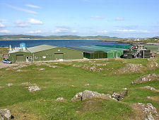
Which makes it a little ironic that some of the most recent development in the area has also been to do with the production of energy, though in a very different and more sustainable way. In 2002 the Danish company Vestas opened a plant next to the airfield at Machrihanish to build wind turbines. The plant has since changed ownership, but remains in production. As you look north to Kintyre from Machrihanish you can see some of the many windfarms that now populate the inaccessible upland interior of the peninsula.
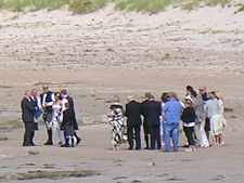
 Machrihanish Bay and the Golf Links from Machrihanish: With a Wedding Taking Place on the Beach Near the Centre of the Image |

|
|
|
Visitor InformationView Location on MapWhat3Words Location: ///embodied.chop.valuables |
 Machrihanish Golf Club |
 Putting Practice |
 The Golf Course |
 Ladies Clubhouse |
 The Old Club House |
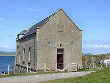 Old Lifeboat Station |
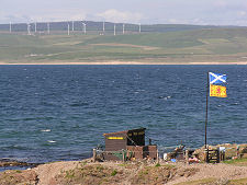 Distant View of Wind Farms |
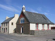 Converted Church & Cottage |