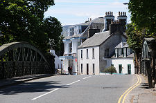
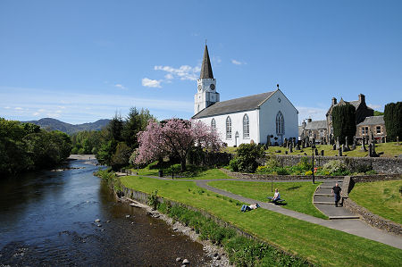
 The River Earn and The White Church from the Dalingross Bridge |
Comrie lies five miles west of Crieff where the east west valley of Strathearn narrows and meets Glen Lednock and its old drove route from the north, and Glen Artney from the south-west. This was the site of an early bridge over the River Earn, and that assured the growth of a settlement here. The strategic importance of the location was first recognised by the Romans during one of their excursions into Scotland. They built a fort on the south bank of the River Earn, opposite the site of today's village.
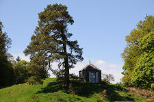
Comrie's other main claim to fame is that it is the earthquake capital of the UK, being subject to more, and more intense, earthquakes than anywhere else in these islands. This may be because it lies close to the Highland Boundary Fault, the line that carves from south-west to north-east right across Scotland. Because of this it is sometimes referred to as the "Shaky Toun" or, in Gaelic, "Am Baile Critheanach". Visitors today can view the Earthquake House, built in 1874 on the edge of the village to house sensors.
The growth of Comrie in the early 1800s owed much to its attractive location as a place for the wealthy to live and to visit. This in turn brought the railway, and in 1893 the Caledonian Railway completed a branch line from Crieff. This was later continued west to link to the Callander and Oban railway at Lochearnhead. The link to the west of Comrie closed in 1951, and that from Crieff in 1964.
The 1900s saw hydroelectric power developed in a number of the glens around Comrie. In Glen Lednock a dam was built, and to the west, water was piped from Loch Earn to another power station. Meanwhile Comrie continued to be an attractive retirement village, giving it the highest proportion of males aged over 65 in Scotland in the 1990s.
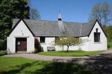
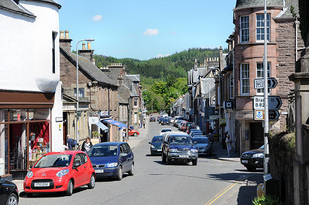
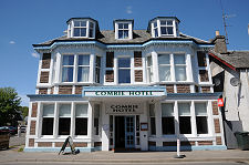
The village itself is made up of a single long main street which turns at its west end before heading out towards Lochearnhead. In the centre of the village, overlooked by the Royal Hotel, is the main junction with the road south. This crosses the Dalingross Bridge over the River Earn, which is overlooked by the striking "White Church" built in 1805. In 1965 the Church of Scotland handed over the building to serve the village as a community centre. In 2000 the centre underwent a major refurbishment with the support of the Millennium Commission and many other funders.
The village is set back a little from the banks of the River Earn, and is also constrained by hills to the north. Most of the growth has therefore taken place on the south side of the river in Dalginross, on and around the site of the original Roman fort. It is difficult to believe when you visit on a fine day, but Comrie all too frequently appears in the news during bad weather as it is especially prone to flooding, largely because two other rivers flow into the River Earn here, the River Lednock to the north and the Water of Ruchill from the south-west.
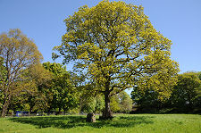
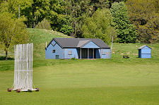
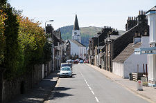
At the east end of the village, Drummond Street crosses the River Lednock. Close by are the Roman Catholic and Scottish Episcopal churches, while a little back towards the centre of Comrie is the very attractive Comrie Hotel. Where this end of the village meets the countryside you find the village cricket ground, while nearby is St Serf's Wild Flower Meadow, complete with a fine oak tree planted to mark the coronation of Edward VII.
The White Church probably ensures that no-one has ever driven through Comrie entirely without registering the village, though it is a settlement it is all too easy to overlook. But its attractive main street and superb riverside location, plus the views from Dalingross Bridge, makes it somewhere well worth exploring.
 Looking East along Drummond Street |

|
|
|
Visitor InformationView Location on MapWhat3Words Location: ///lists.flotation.howler |
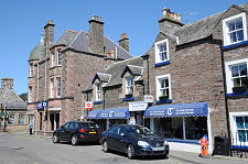
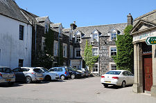 Royal Hotel |
 Comrie Fish and Chip Shop |
 Drummond Street, Looking West |
 Comrie Hotel |
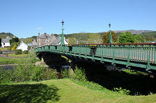 Dalginross Bridge |