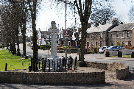
 War Memorial and Village Green |
Carstairs is a name applied in different ways to three separate settlements on or around the A70 Ayr to Edinburgh road, a few miles east of Lanark. The oldest is Carstairs itself, a village made a Royal Burgh by King David I as early as 1128, 14 years before Lanark. At the north-east end of the village was an early royal castle, now long gone.
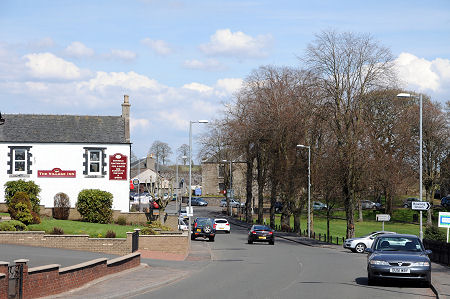
On the main road through Carstairs are the white-painted Village Inn, a reminder of the days when this was an important coaching route across Scotland. The Carstairs Arms Hotel that once stood nearby was simply a derelict site when we last visited the village. Settlement in the area dates back far beyond the days of the coach routes, however, and the Castledykes Roman fort is just a mile to the south-east of the village.
It seems likely that the village got its name from a corruption of Castra Terras or "Fort Land" because of the presence of the Roman Fort. Though it doesn't seem it, Carstairs lies at a height of 230m on a plateau extending east from the tail of the Pentland Hills.
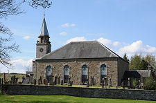
The heart of the village is the village green. This was the site of an annual fair, also known as the Gala Day, derived from Gallows Day: the one day per year when the laird was allowed to publicly hang wrongdoers for the wider entertainment of residents and visitors alike. Overlooking the village green from the east today is the war memorial. Beyond it is Carstairs Parish Church, built in 1795. The church is just 51ft long by 23ft wide: with a 53ft steeple making its greatest dimension the vertical one.
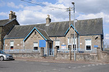
The east side of the village green is also home to Carstairs' main community facilities, and in particular the Carstairs Village Community Centre, in the old village school, and the next-door Carstairs Surgery, which orignally served as the schoolteacher's house.
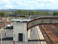
A mile east of Carstairs is Carstairs Junction. Originally called Strawfrank, this is where the main west coast railway line from Carlisle to Glasgow diverges from the line to Edinburgh. The junction was established in the 1860s and the settlement rapidly followed the development of railway workshops here. Carstairs Junction has featured on the itineraries of generations of rail travellers to Scotland and the village retains both its station and its railway community feel.
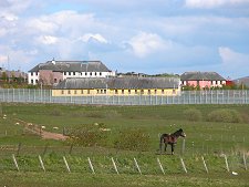
The third settlement associated with the name of Carstairs lies north-east of Carstairs Junction and east of Carstairs. This is the Carstairs State Hospital, which provides secure psychiatric care for Scotland and Northern Ireland. With the demise in recent decades of the area's coal industry, the State Hospital has assumed an increasingly important role in the local economy. The small village in which the hospital is located is known as West End Carnwath.
 Approaching Carstairs from Lanark |

|
|
|
Visitor InformationView Location on MapWhat3Words Location: ///clef.says.january |
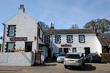 The Village Inn |
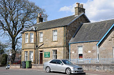
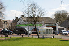 Village Green and Co-Op |
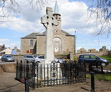 War Memorial and Church |